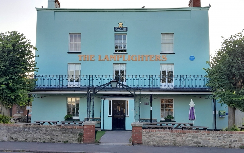
Latitude: 51.4836 / 51°29'0"N
Longitude: -2.6824 / 2°40'56"W
OS Eastings: 352708
OS Northings: 176292
OS Grid: ST527762
Mapcode National: GBR JL.KRZN
Mapcode Global: VH88D.GZ81
Plus Code: 9C3VF8M9+C2
Entry Name: The Lamplighters Public House
Listing Date: 30 December 1994
Grade: II
Source: Historic England
Source ID: 1202597
English Heritage Legacy ID: 380609
ID on this website: 101202597
Location: Pill, Bristol, BS11
County: City of Bristol
Electoral Ward/Division: Avonmouth and Lawrence Weston
Parish: Non Civil Parish
Built-Up Area: Bristol
Traditional County: Gloucestershire
Lieutenancy Area (Ceremonial County): Bristol
Church of England Parish: Shirehampton
Church of England Diocese: Bristol
Tagged with: Pub
BRISTOL
ST57NW STATION ROAD, Shirehampton 901-1/52/1766 (East side) The Lamplighters Public House
II
Public house. Late C18. Render and Pennant rubble, brick gable stacks and double Roman tiled hipped roof. Double-depth plan. Late Georgian style. 3 storeys; 3-window range. A symmetrical parapeted front has a central doorway with mid C20 porch, 6/6-pane sashes, horned on the ground floor, and first-floor French windows to a full-width balcony on cast-iron stanchions, curved spandrel brackets and oval railings. Rubble right-hand 2-window return, rendered 3-window left return. The rear roof is in 3 hipped sections, deeper to the left side which projects back. INTERIOR altered in C20.
Listing NGR: ST5270876292
External links are from the relevant listing authority and, where applicable, Wikidata. Wikidata IDs may be related buildings as well as this specific building. If you want to add or update a link, you will need to do so by editing the Wikidata entry.


Other nearby listed buildings