Latitude: 52.3643 / 52°21'51"N
Longitude: -2.7176 / 2°43'3"W
OS Eastings: 351233
OS Northings: 274269
OS Grid: SO512742
Mapcode National: GBR BK.S5NP
Mapcode Global: VH843.VT5X
Plus Code: 9C4V977J+PX
Entry Name: 35 and 36, Lower Broad Street
Listing Date: 15 March 1974
Grade: II
Source: Historic England
Source ID: 1202888
English Heritage Legacy ID: 389982
ID on this website: 101202888
Location: Ludford, Shropshire, SY8
County: Shropshire
Civil Parish: Ludlow
Built-Up Area: Ludlow
Traditional County: Shropshire
Lieutenancy Area (Ceremonial County): Shropshire
Church of England Parish: Ludlow St Laurence
Church of England Diocese: Hereford
Tagged with: Building
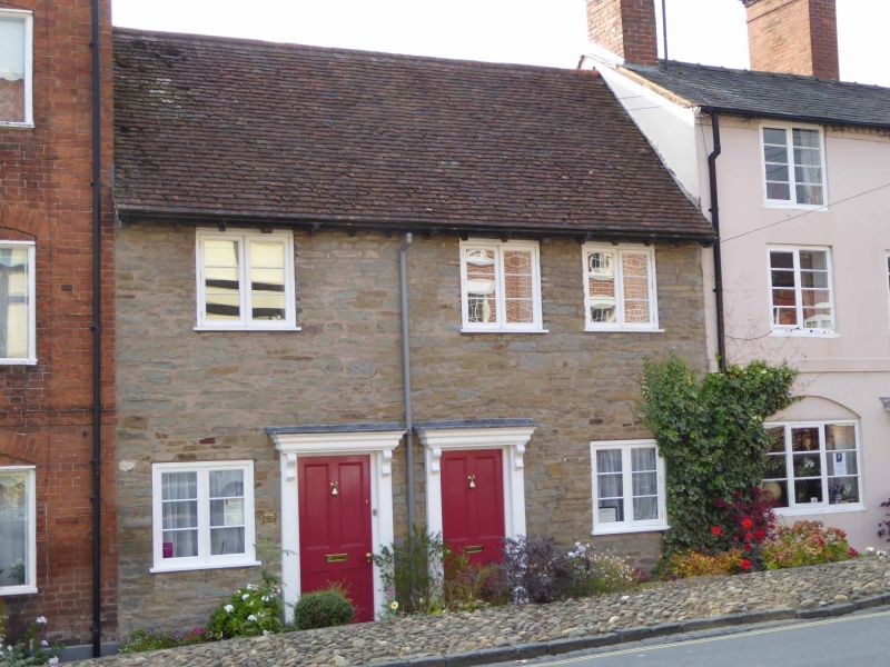
LUDLOW
SO5174 LOWER BROAD STREET
825-1/1/349 (West side)
15/03/74 Nos.35 AND 36
GV II
Houses. C17. Rubble; plain tile roof. 2-storeys; 3-window
range: C20 sashes with lattice lights. Two C20 panelled doors,
part lattice-glazed, to centre; flanked by sashes as over.
Twin gabled wings to rear, rendered, with C20 fenestration.
Included for group value.
Listing NGR: SO5123674272
External links are from the relevant listing authority and, where applicable, Wikidata. Wikidata IDs may be related buildings as well as this specific building. If you want to add or update a link, you will need to do so by editing the Wikidata entry.


Other nearby listed buildings