Approximate Location Map
Large Map »
Latitude: 52.3645 / 52°21'52"N
Longitude: -2.7173 / 2°43'2"W
OS Eastings: 351254
OS Northings: 274288
OS Grid: SO512742
Mapcode National: GBR BK.S5QT
Mapcode Global: VH843.VTBS
Plus Code: 9C4V977M+Q3
Entry Name: 24-27, Lower Broad Street
Listing Date: 9 February 1988
Grade: II
Source: Historic England
Source ID: 1210798
English Heritage Legacy ID: 389979
ID on this website: 101210798
Location: Ludford, Shropshire, SY8
County: Shropshire
Civil Parish: Ludlow
Built-Up Area: Ludlow
Traditional County: Shropshire
Lieutenancy Area (Ceremonial County): Shropshire
Church of England Parish: Ludlow St Laurence
Church of England Diocese: Hereford
Tagged with: Building
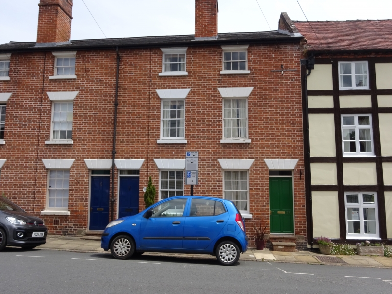
LUDLOW
SO5174 LOWER BROAD STREET
825-1/1/346 (East side)
09/02/88 Nos.24-27 (Consecutive)
GV II
Cottages. Mid C19. Brick; Welsh slate roof; brick stacks to
front and rear. 4-unit terrace. 3-storeys; 4-window range:
C19, 6/6 sashes to ground and 1st floors; 3/3 sashes over.
4-panel doors, that to No.26 part-glazed, with overlights;
grooved stucco lintels. C19 sash windows to rear.
Listing NGR: SO5125674290
External links are from the relevant listing authority and, where applicable, Wikidata. Wikidata IDs may be related buildings as well as this specific building. If you want to add or update a link, you will need to do so by editing the Wikidata entry.


Other nearby listed buildings
