Latitude: 50.5606 / 50°33'38"N
Longitude: -2.4439 / 2°26'38"W
OS Eastings: 368651
OS Northings: 73522
OS Grid: SY686735
Mapcode National: GBR PZ.2L42
Mapcode Global: FRA 57RL.5PW
Plus Code: 9C2VHH64+6C
Entry Name: Churchyard Walls and Piers to Church of St John
Listing Date: 21 September 1978
Grade: II
Source: Historic England
Source ID: 1203084
English Heritage Legacy ID: 381940
ID on this website: 101203084
Location: St John the Baptist's Church, Fortuneswell, Dorset, DT5
County: Dorset
Civil Parish: Portland
Built-Up Area: Fortuneswell
Traditional County: Dorset
Lieutenancy Area (Ceremonial County): Dorset
Church of England Parish: Portland All Saints
Church of England Diocese: Salisbury
Tagged with: Churchyard wall
PORTLAND
SY6873 FORTUNESWELL, Fortuneswell 969-1/3/92 (North East side) 21/09/78 Churchyard walls and piers to Church of St. John
GV II
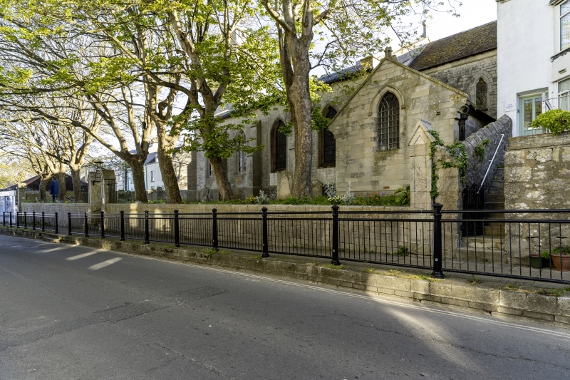
Churchyard boundary walls, gate piers, railings, and steps. 1839-40. Portland ashlar, wrought and cast-iron. Wall in squared and coursed block, running to follow slope of hill and not horizontally, to plain flush weathered coping, rises to c 1.5m full width of churchyard. At each end a single pier, and to centre a pair of piers raised on simple plinth to wall height and flanking a set of 8 plain stone steps in return walls; these piers retain a simple iron overthrow, and are flanked each side by a run of c 1m of iron railing. All the piers are square, with sunk panel to face, under gabled capping to stepped weatherings and roll capping. At the left end is an opening to further flight of steps, and to their left, along the NW boundary of the churchyard, a wall swept up at the far end by a flight fo 12 steps to a gate giving to the former Rectory garden.
Listing NGR: SY6865173522
External links are from the relevant listing authority and, where applicable, Wikidata. Wikidata IDs may be related buildings as well as this specific building. If you want to add or update a link, you will need to do so by editing the Wikidata entry.


Other nearby listed buildings