Approximate Location Map
Large Map »
Latitude: 51.389 / 51°23'20"N
Longitude: 1.3825 / 1°22'57"E
OS Eastings: 635434
OS Northings: 170982
OS Grid: TR354709
Mapcode National: GBR WZS.VRP
Mapcode Global: VHLG6.XC81
Plus Code: 9F3399QM+J2
Entry Name: 7, Lombard Street
Listing Date: 22 February 1973
Grade: II
Source: Historic England
Source ID: 1203727
English Heritage Legacy ID: 356611
ID on this website: 101203727
Location: Margate, Thanet, Kent, CT9
County: Kent
District: Thanet
Electoral Ward/Division: Margate Central
Parish: Non Civil Parish
Built-Up Area: Margate
Traditional County: Kent
Lieutenancy Area (Ceremonial County): Kent
Tagged with: Building
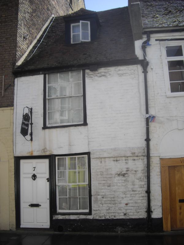
LOMBARD STREET
1.
1380
(South Side)
No 7
TR 3570 NW 1/225
II GV
2.
Early C18. 2 storeys painted brick. Restored tiled roof with 1 hipped dormer.
1 sash set in moulded architrave. Left side doorcase with 6 panelled door.
Nos 6 to 9 (consec) form a group
Listing NGR: TR3543470982
External links are from the relevant listing authority and, where applicable, Wikidata. Wikidata IDs may be related buildings as well as this specific building. If you want to add or update a link, you will need to do so by editing the Wikidata entry.


Other nearby listed buildings
