Approximate Location Map
Large Map »
Latitude: 53.4902 / 53°29'24"N
Longitude: -1.8953 / 1°53'42"W
OS Eastings: 407046
OS Northings: 399279
OS Grid: SK070992
Mapcode National: GBR HX62.GL
Mapcode Global: WHB9M.VJPQ
Plus Code: 9C5WF4R3+3V
Entry Name: Crowden Bridge 200 Yards North West of Crowden Old Vicarage
Listing Date: 15 March 1984
Grade: II
Source: Historic England
Source ID: 1203942
English Heritage Legacy ID: 82177
ID on this website: 101203942
Location: Crowden, High Peak, Derbyshire, SK13
County: Derbyshire
District: High Peak
Civil Parish: Tintwistle
Traditional County: Cheshire
Lieutenancy Area (Ceremonial County): Derbyshire
Church of England Parish: Tintwistle Christ Church
Church of England Diocese: Chester
Tagged with: Bridge
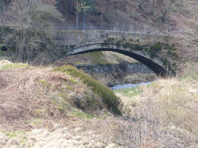
SK 09 NE PARISH OF TINTWISTLE WOODHEAD OLD ROAD
Crowden Bridge, 200 yards
north west of Crowden Old
Vicarage
II
Bridge. Late C18. Coursed squared gritstone. Single shallow arch, with projecting
square section drip mould. Canted side walls with chamfered coping stones.
Listing NGR: SK0704699279
External links are from the relevant listing authority and, where applicable, Wikidata. Wikidata IDs may be related buildings as well as this specific building. If you want to add or update a link, you will need to do so by editing the Wikidata entry.


Other nearby listed buildings
