Latitude: 53.492 / 53°29'31"N
Longitude: -1.8804 / 1°52'49"W
OS Eastings: 408034
OS Northings: 399479
OS Grid: SK080994
Mapcode National: GBR HX91.PY
Mapcode Global: WHCBS.2HVB
Plus Code: 9C5WF4R9+QV
Entry Name: Bleak House and Boundary Wall and Railings
Listing Date: 15 March 1984
Grade: II
Source: Historic England
Source ID: 1334810
English Heritage Legacy ID: 82175
ID on this website: 101334810
Location: Crowden, High Peak, Derbyshire, SK13
County: Derbyshire
District: High Peak
Civil Parish: Tintwistle
Traditional County: Cheshire
Lieutenancy Area (Ceremonial County): Derbyshire
Church of England Parish: Tintwistle Christ Church
Church of England Diocese: Chester
SK 09 NE PARISH OF TINTWISTLE WOODHEAD ROAD 5/31 (North Side) Bleak House and boundary wall and railings GV II
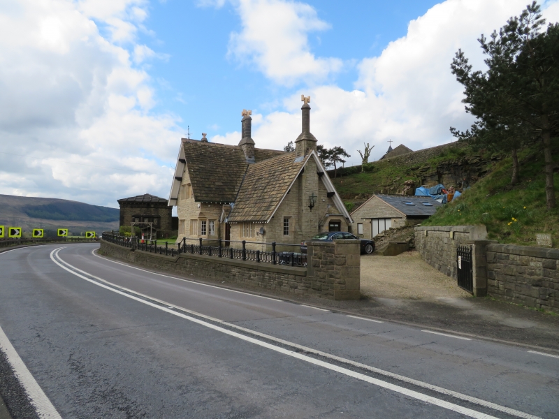
House. C1880. Random coursed gritstone with gritstone dressings. Stone slate steeply pitched roof with deeply overhanging eaves. Ridge stack, gable end stack and eaves stack. Stacks are circular on rectangular bases. Two storeys and single storey east wing. South elevation: all windows have recessed chamfered mullions and eight-paned glazing bars with top hung casements. Gabled bay with two 3-light windows to the ground floor with a fourth light on the corner which is cut away at an angle to resemble a chamfer with stops. To the first floor two 2-light windows linked by a blocked panel of equal size. Blind spherical triangle in the gable. Single storey wing with gabled porch hood and recessed porch. C20 door. 4-light window to the right. To the road a low, coped wall surmounted by iron railings.
Listing NGR: SK0803499479
External links are from the relevant listing authority and, where applicable, Wikidata. Wikidata IDs may be related buildings as well as this specific building. If you want to add or update a link, you will need to do so by editing the Wikidata entry.


Other nearby listed buildings