Approximate Location Map
Large Map »
Latitude: 51.3896 / 51°23'22"N
Longitude: 1.381 / 1°22'51"E
OS Eastings: 635323
OS Northings: 171046
OS Grid: TR353710
Mapcode National: GBR WZS.V98
Mapcode Global: VHLG6.WBFK
Plus Code: 9F3399QJ+V9
Entry Name: 13, 14, 14A, 15 and 16, the Parade
Listing Date: 22 February 1973
Grade: II
Source: Historic England
Source ID: 1203977
English Heritage Legacy ID: 356650
ID on this website: 101203977
Location: Margate, Thanet, Kent, CT9
County: Kent
District: Thanet
Electoral Ward/Division: Margate Central
Parish: Non Civil Parish
Built-Up Area: Margate
Traditional County: Kent
Lieutenancy Area (Ceremonial County): Kent
Tagged with: Building
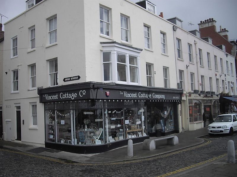
THE PARADE
1.
1380
No 13
Nos 14 and 14A
Nos 15 and 16
TR 3571 SW 2/273
II GV
2.
Mid C19. 3 storeys and attics. Stuccoed. Tiled roof with 5 dormers.
Stone coping. 12 sashes in all, mostly with verticals only. No 13 has 1
4-light bay on the 1st floor. Ground floor has later shopfronts.
Nos 13 to 16 (consec) form a group
Listing NGR: TR3532371045
External links are from the relevant listing authority and, where applicable, Wikidata. Wikidata IDs may be related buildings as well as this specific building. If you want to add or update a link, you will need to do so by editing the Wikidata entry.


Other nearby listed buildings
