Approximate Location Map
Large Map »
Latitude: 51.3011 / 51°18'3"N
Longitude: 0.3372 / 0°20'13"E
OS Eastings: 563026
OS Northings: 158364
OS Grid: TQ630583
Mapcode National: GBR Z4.ZMS
Mapcode Global: VHHPN.SKMG
Plus Code: 9F32882P+CV
Entry Name: Nepicar Lodge
Listing Date: 3 May 1984
Grade: II
Source: Historic England
Source ID: 1204298
English Heritage Legacy ID: 357307
ID on this website: 101204298
Location: Wrotham Heath, Tonbridge and Malling, Kent, TN15
County: Kent
District: Tonbridge and Malling
Civil Parish: Platt
Traditional County: Kent
Lieutenancy Area (Ceremonial County): Kent
Church of England Parish: Platt St Mary the Virgin
Church of England Diocese: Rochester
Tagged with: Gatehouse
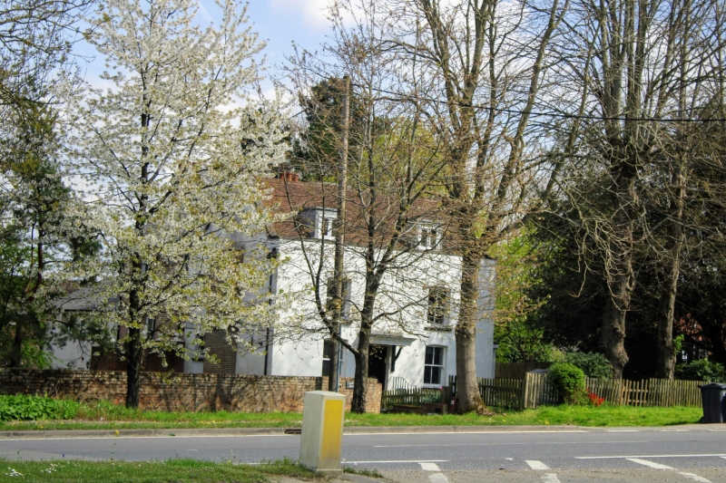
TQ 65 NW PLATT LONDON ROAD
2/5 (north side)
Nepicar Lodge
II
House. Later C18. Cement rendered elevation. Parapet to plain tiled roof with 2
hipped dormers and end stacks. Basement, with area, 2 storeys and attic; symmetrical
2 window facade, glazing bar sashes, except basement with mullioned casements.
Central panelled door with 2 steps up to entrance over area and cast-iron hand-rails.
Listing NGR: TQ6303058367
External links are from the relevant listing authority and, where applicable, Wikidata. Wikidata IDs may be related buildings as well as this specific building. If you want to add or update a link, you will need to do so by editing the Wikidata entry.


Other nearby listed buildings
