Latitude: 51.5416 / 51°32'29"N
Longitude: -0.109 / 0°6'32"W
OS Eastings: 531236
OS Northings: 184220
OS Grid: TQ312842
Mapcode National: GBR M1.PJ
Mapcode Global: VHGQT.2J71
Plus Code: 9C3XGVRR+MC
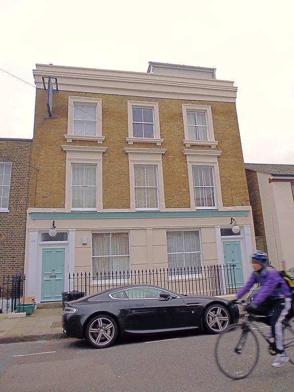
Entry Name: 57, Brooksby Street
Listing Date: 30 September 1994
Grade: II
Source: Historic England
Source ID: 1205126
English Heritage Legacy ID: 368599
ID on this website: 101205126
Location: Barnsbury, Islington, London, N1
County: London
District: Islington
Electoral Ward/Division: Barnsbury
Parish: Non Civil Parish
Built-Up Area: Islington
Traditional County: Middlesex
Lieutenancy Area (Ceremonial County): Greater London
Church of England Parish: St Andrew Barnsbury
Church of England Diocese: London
Tagged with: Building
ISLINGTON
TQ3184SW BROOKSBY STREET 635-1/52/109 (South side) No.57
GV II
Formerly known as: The Rising Sun Public House BROOKSBY STREET. Public House, now flats. Mid-C19. Stucco and yellow brick set in Flemish bond, roof obscured by parapet. Three storeys over basement, three windows. Ground floor decorated with banded rustication and incorporating panelled and fluted pilasters and fascia, presumably from former public house front; two flat-arched entrances with overlights; all windows flat-arched; two windows to ground floor introduced; first-floor windows have architrave and cornice, second-floor architrave only; cornice and blocking course; side stacks. Included for group value.
Listing NGR: TQ3123684220
External links are from the relevant listing authority and, where applicable, Wikidata. Wikidata IDs may be related buildings as well as this specific building. If you want to add or update a link, you will need to do so by editing the Wikidata entry.


Other nearby listed buildings