Approximate Location Map
Large Map »
Latitude: 53.067 / 53°4'1"N
Longitude: -2.5219 / 2°31'18"W
OS Eastings: 365127
OS Northings: 352323
OS Grid: SJ651523
Mapcode National: GBR 7S.BZXK
Mapcode Global: WH9BB.75CL
Plus Code: 9C5V3F8H+R7
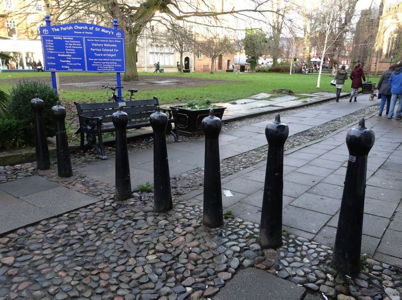
Entry Name: 7 Bollards at South West Corner of Churchyard
Listing Date: 1 March 1974
Grade: II
Source: Historic England
Source ID: 1206069
English Heritage Legacy ID: 56607
ID on this website: 101206069
Location: Nantwich, Cheshire East, Cheshire, CW5
County: Cheshire East
Civil Parish: Nantwich
Built-Up Area: Nantwich
Traditional County: Cheshire
Lieutenancy Area (Ceremonial County): Cheshire
Church of England Parish: Nantwich St Mary
Church of England Diocese: Chester
Tagged with: Bollard
1.
1425 CHURCHYARD SIDE
---------------
7 bollards at south-
west corner of churchyard
SJ 6552 1/90
II
2.
C19 cast-iron baluster type with mushroom caps.
Listing NGR: SJ6512752323
External links are from the relevant listing authority and, where applicable, Wikidata. Wikidata IDs may be related buildings as well as this specific building. If you want to add or update a link, you will need to do so by editing the Wikidata entry.


Other nearby listed buildings
