Latitude: 51.7179 / 51°43'4"N
Longitude: -1.9698 / 1°58'11"W
OS Eastings: 402182
OS Northings: 202135
OS Grid: SP021021
Mapcode National: GBR 3QY.6TJ
Mapcode Global: VHB2Q.T20V
Plus Code: 9C3WP29J+53
Entry Name: Group of two chest tombs approximately 15 metres West of former Unitarian Chapel
Listing Date: 24 May 1993
Grade: II
Source: Historic England
Source ID: 1206175
English Heritage Legacy ID: 365350
ID on this website: 101206175
Location: Cirencester, Cotswold, Gloucestershire, GL7
County: Gloucestershire
District: Cotswold
Civil Parish: Cirencester
Built-Up Area: Cirencester
Traditional County: Gloucestershire
Lieutenancy Area (Ceremonial County): Gloucestershire
Church of England Parish: Cirencester St John the Baptist
Church of England Diocese: Gloucester
Tagged with: Chest tomb
This list entry was subject to a Minor Amendment on 8 July 2024 to amend the name, address and reformat the text to current standards
SP0202
578-1/4/214
CIRENCESTER
GOSDITCH STREET (West side (off))
Group of two chest tombs approximately 15 metres West of former Unitarian Chapel
(Formerly listed as Group of 2 chest tombs approx. 15m W of Unitarian Chapel)
GV
II
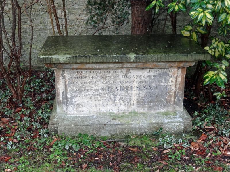
Two chest tombs. Mid C18 and 1846. Limestone. Mid C18 chest tomb to H ... W ... has baluster corners, panelled sides, heavy moulded ledger stone; 1846 chest tomb to Charles Smith. Churchyard heavily overgrown, description difficult.
Listing NGR: SP0218202135
External links are from the relevant listing authority and, where applicable, Wikidata. Wikidata IDs may be related buildings as well as this specific building. If you want to add or update a link, you will need to do so by editing the Wikidata entry.


Other nearby listed buildings