Latitude: 52.0549 / 52°3'17"N
Longitude: -2.7156 / 2°42'56"W
OS Eastings: 351030
OS Northings: 239853
OS Grid: SO510398
Mapcode National: GBR FL.DM0N
Mapcode Global: VH85N.WM72
Plus Code: 9C4V373M+XQ
Entry Name: Walls at the Precentor's House
Listing Date: 22 October 1973
Last Amended: 27 July 1994
Grade: II
Source: Historic England
Source ID: 1206197
English Heritage Legacy ID: 372294
ID on this website: 101206197
Location: Hereford, County of Herefordshire, HR1
County: County of Herefordshire
Civil Parish: Hereford
Built-Up Area: Hereford
Traditional County: Herefordshire
Lieutenancy Area (Ceremonial County): Herefordshire
Tagged with: Wall
HEREFORD
SO5139NW CATHEDRAL CLOSE
683-1/7/358 Walls at the Precentor's House
22/10/73
(Formerly Listed as:
CATHEDRAL CLOSE
Wall at Canon's House)
II
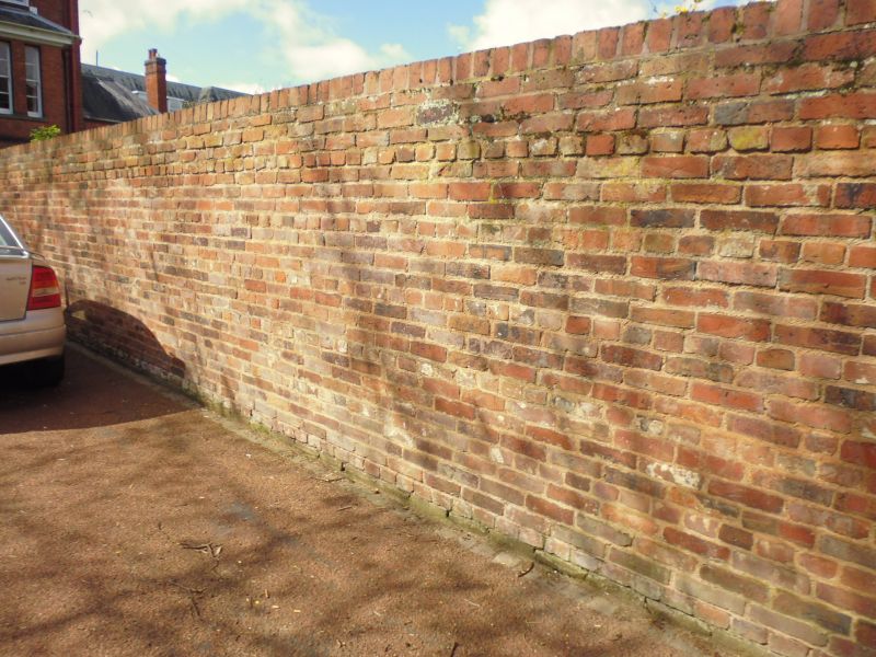
Walls. C18. Curved red brick wing walls and boundary walls to
left and right. Approximately 2m high.
Listing NGR: SO5103039852
External links are from the relevant listing authority and, where applicable, Wikidata. Wikidata IDs may be related buildings as well as this specific building. If you want to add or update a link, you will need to do so by editing the Wikidata entry.


Other nearby listed buildings