Latitude: 50.4536 / 50°27'13"N
Longitude: -4.462 / 4°27'43"W
OS Eastings: 225323
OS Northings: 64429
OS Grid: SX253644
Mapcode National: GBR NF.NZMF
Mapcode Global: FRA 17JV.KJF
Plus Code: 9C2QFG3Q+F6
Entry Name: The Barley Sheaf Public House
Listing Date: 22 July 1981
Last Amended: 15 November 1993
Grade: II
Source: Historic England
Source ID: 1206296
English Heritage Legacy ID: 382153
Also known as: Barley Sheaf
ID on this website: 101206296
Location: Liskeard, Cornwall, PL14
County: Cornwall
Civil Parish: Liskeard
Built-Up Area: Liskeard
Traditional County: Cornwall
Lieutenancy Area (Ceremonial County): Cornwall
Church of England Parish: Liskeard
Church of England Diocese: Truro
Tagged with: Pub
LISKEARD
SW2564 CHURCH STREET 979-1/5/59 (West side) 22/07/81 The Barley Sheaf Public House (Formerly Listed as: CHURCH STREET (West side) The Wheatsheaf)
GV II
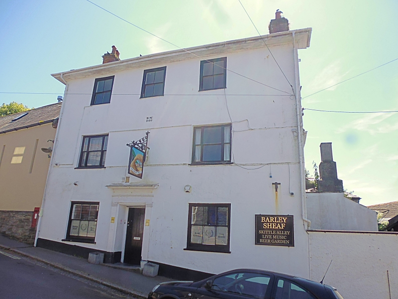
Public house. 1825 inscription and initials RM. Rendered walls; on masonry to lower floor, on studwork above; fairly steep sprocketed bitumen-grouted slate roof with late C19 crested clay ridge tiles and brick end stacks; wide, returned eaves at the front with moulded cornice. Shallow plan later extended at rear. 3 storeys; nearly symmetrical 3-window (2nd floor) front. Mid/late C19 horned sashes, within moulded wooden architraves to upper floor, within reveals to other floors including the 2 tripartite sashes to 1st floor; central doorway with original wooden doorcase with flat pilasters, moulded and enriched entablature and 4-panel door. INTERIOR of ground floor has been altered in the C20 but retains original fireplaces.
Listing NGR: SX2532364429
External links are from the relevant listing authority and, where applicable, Wikidata. Wikidata IDs may be related buildings as well as this specific building. If you want to add or update a link, you will need to do so by editing the Wikidata entry.


Other nearby listed buildings