Latitude: 53.259 / 53°15'32"N
Longitude: -2.1165 / 2°6'59"W
OS Eastings: 392324
OS Northings: 373559
OS Grid: SJ923735
Mapcode National: GBR FZNR.LG
Mapcode Global: WHBBP.GBCY
Plus Code: 9C5V7V5M+H9
Entry Name: 136 and 136A, Buxton Road
Listing Date: 28 October 1994
Grade: II
Source: Historic England
Source ID: 1206887
English Heritage Legacy ID: 390922
ID on this website: 101206887
Location: Macclesfield, Cheshire East, Cheshire, SK10
County: Cheshire East
Civil Parish: Macclesfield
Built-Up Area: Macclesfield
Traditional County: Cheshire
Lieutenancy Area (Ceremonial County): Cheshire
Church of England Parish: Macclesfield St Paul
Church of England Diocese: Chester
Tagged with: Building
MACCLESFIELD
SJ9273 BUXTON ROAD 886-1/7/22 (South side) Nos.136 AND 136A
GV II
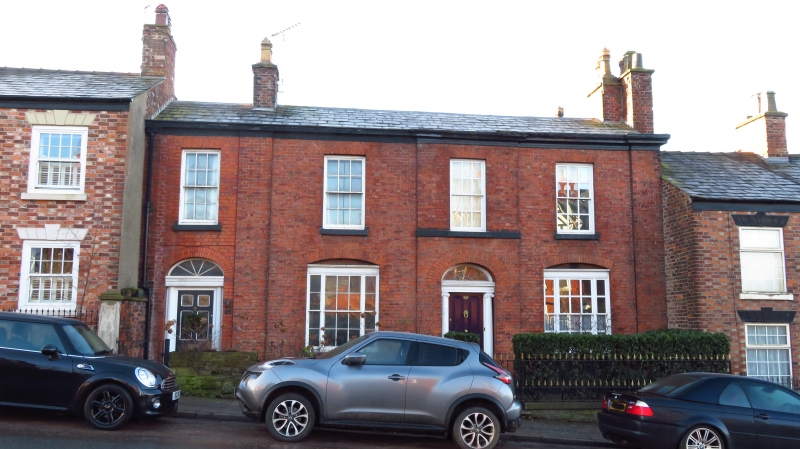
Pair of houses, possibly originally a single dwelling. c1810. Brick with Welsh slate roof. 2 storeys, 4-window range, the main block a symmetrically planned 3-window range with doorway in advanced central bay, and a subsidiary range to the left with secondary door now the entrance to No.136A. Full-height plain pilasters each side of main range. Main door has 4-fielded octagonal panels and traceried overlight in Ionic architrave. Tripartite sash windows each side with segmentally-arched brick heads; 12-pane sash windows to 1st floor, all with flat-arched gauged brick heads. Axial and end wall stacks.
Listing NGR: SJ9232473559
External links are from the relevant listing authority and, where applicable, Wikidata. Wikidata IDs may be related buildings as well as this specific building. If you want to add or update a link, you will need to do so by editing the Wikidata entry.


Other nearby listed buildings