Approximate Location Map
Large Map »
Latitude: 53.2602 / 53°15'36"N
Longitude: -2.1181 / 2°7'5"W
OS Eastings: 392217
OS Northings: 373693
OS Grid: SJ922736
Mapcode National: GBR FZNR.70
Mapcode Global: WHBBP.FBL0
Plus Code: 9C5V7V6J+3Q
Entry Name: Parish Boundary Stone at SJ 9221 7369
Listing Date: 27 March 1986
Grade: II
Source: Historic England
Source ID: 1206957
English Heritage Legacy ID: 391117
ID on this website: 101206957
Location: Victoria Park, Macclesfield, Cheshire East, Cheshire, SK10
County: Cheshire East
Civil Parish: Macclesfield
Built-Up Area: Macclesfield
Traditional County: Cheshire
Lieutenancy Area (Ceremonial County): Cheshire
Church of England Parish: Hurdsfield Holy Trinity
Church of England Diocese: Chester
Tagged with: Boundary marker
SJ97SW
886-1/4/219
27/03/86
MACCLESFIELD
VICTORIA PARK
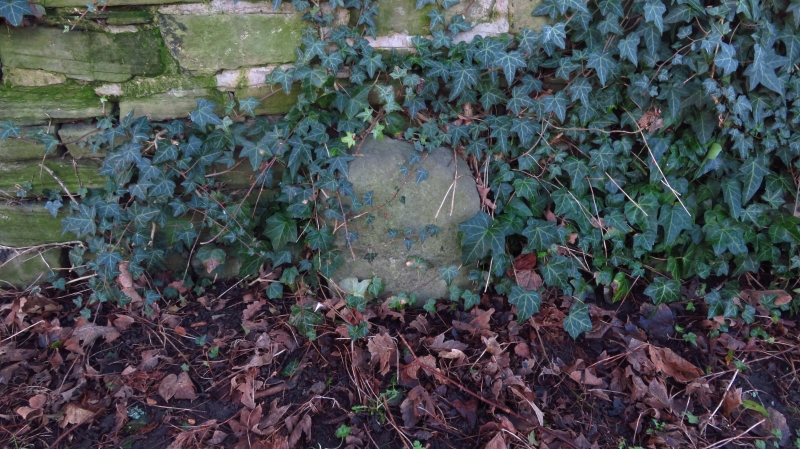
Parish boundary stone at SJ 9221 7369
II
Boundary stone. Early/mid C19. Stone. Worn semicircular-headed
block with inscription no longer decipherable.
Listing NGR: SJ 92217 73693
External links are from the relevant listing authority and, where applicable, Wikidata. Wikidata IDs may be related buildings as well as this specific building. If you want to add or update a link, you will need to do so by editing the Wikidata entry.


Other nearby listed buildings
