Latitude: 51.2098 / 51°12'35"N
Longitude: -3.4821 / 3°28'55"W
OS Eastings: 296567
OS Northings: 146668
OS Grid: SS965466
Mapcode National: GBR LJ.41P3
Mapcode Global: VH5JY.LVJF
Plus Code: 9C3R6G59+W5
Entry Name: Stables, Gateway and Wall on Corner of Vicarage Road
Listing Date: 28 October 1976
Last Amended: 30 September 1994
Grade: II
Source: Historic England
Source ID: 1206986
English Heritage Legacy ID: 391191
ID on this website: 101206986
Location: Higher Town, Somerset, TA24
County: Somerset
District: Somerset West and Taunton
Civil Parish: Minehead
Built-Up Area: Minehead
Traditional County: Somerset
Lieutenancy Area (Ceremonial County): Somerset
Tagged with: Stable
MINEHEAD
SS9646 MOOR ROAD 900-1/3/40 (South side) 28/10/76 Stables, gateway and wall on corner of Vicarage Road (Formerly Listed as: MOOR ROAD (South side) Stable range with gateway and wall to stableyard on corner of Vicarage Road)
GV II
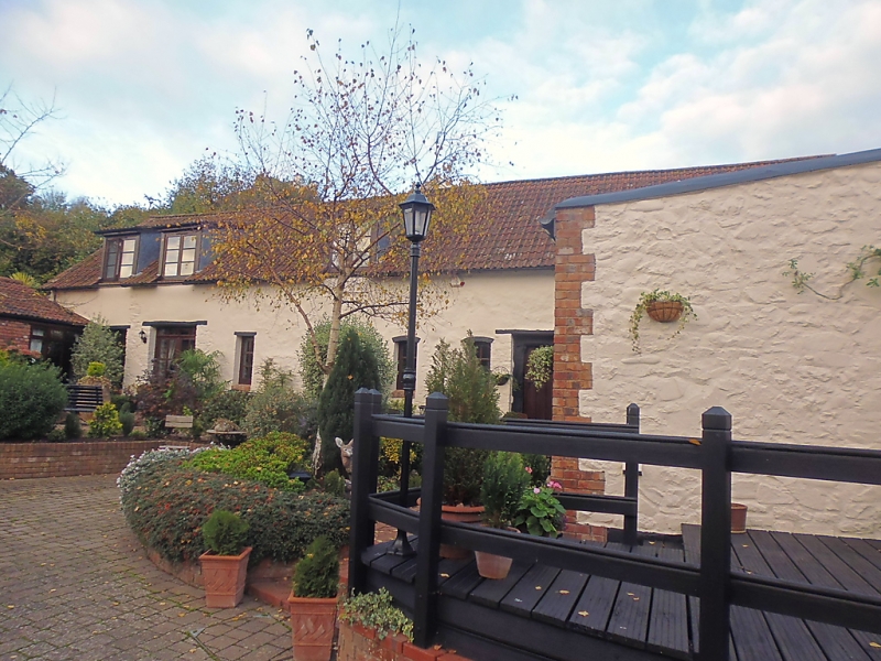
Stables, gateway and wall. C17 gateway; C17 and later walls; C17 stables and attached C19 outbuildings. Rubblestone stable with pantile roof; east elevation of painted stone with cob; outbuildings of pantile roofs; rubblestone wall and gate piers with pantile overthrow. Buildings enclose yard to the south and west. Mid C19 one-storey range with doorways facing yard to south. The west side of yard is bounded by a taller early/mid C19 former stable range with timber lintels over doorways and window openings; east elevation has 2 stable doors, entrance door with old oak frame, doorway to tack room, 2 narrow windows and a hay loft opening. INTERIOR of stable has 4 pairs of jointed crucks (a notable example for this area), with face-pegged joints, trenching for purlins to principals and morticed collars. Subsidiary Features: these buildings are attached to and enclosed by a wall to the right along Moor Road to north (approx 3m high and 15m long) and left along Vicarage Road to east (approx 2m high and 20m long). The gateway at the corner, facing Moor Road, has a C17 moulded architrave approx 4m high and 3m wide between substantial piers of limestone up to 2m; above this the left corner is rounded and corbelled out to red sandstone, probably C19, at the top.
Listing NGR: SS9656746668
External links are from the relevant listing authority and, where applicable, Wikidata. Wikidata IDs may be related buildings as well as this specific building. If you want to add or update a link, you will need to do so by editing the Wikidata entry.


Other nearby listed buildings