Latitude: 51.2138 / 51°12'49"N
Longitude: -3.4751 / 3°28'30"W
OS Eastings: 297063
OS Northings: 147104
OS Grid: SS970471
Mapcode National: GBR LJ.3X03
Mapcode Global: VH5JY.QR6B
Plus Code: 9C3R6G7F+GX
Entry Name: The Old Ship Aground Public House
Listing Date: 28 October 1976
Last Amended: 30 September 1994
Grade: II
Source: Historic England
Source ID: 1206998
English Heritage Legacy ID: 391224
Also known as: Old Ship Aground, Minehead
Old Ship Aground
ID on this website: 101206998
Location: Higher Town, Somerset, TA24
County: Somerset
District: Somerset West and Taunton
Civil Parish: Minehead
Built-Up Area: Minehead
Traditional County: Somerset
Lieutenancy Area (Ceremonial County): Somerset
Tagged with: Pub
MINEHEAD
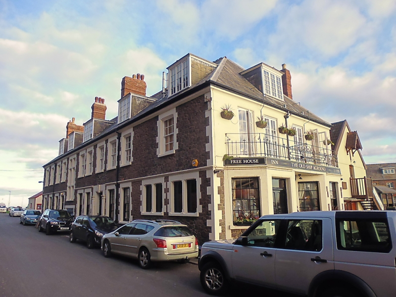
SS9747 QUAY STREET 900-1/2/70 (North side) 28/10/76 The Old Ship Aground Public House (Formerly Listed as: QUAY STREET (North side) Pier Hotel including pair of gatepiers to east)
GV II
Hotel. c1880s remodelling of earlier structure. Rubblestone with freestone dressings, hipped slate roof with 5 large C20 dormers and 3 brick stacks to the south-west slope, one dormer to the south-east, one dormer and 2 brick stacks to north-west. Rectangular plan. 2 storeys with attic; 11-window range to south-west side; 4-window range to south-east end which faces the harbour, on the first floor 4 full-height French windows with small panes open onto a balcony supported by 2 canted bays, these have 6/6-pane sash windows, that to the left has a door with overlight. The south-west facade has mostly 6/6-pane sash windows, rusticated surrounds with moulded arrisses; a string course above ground-floor windows broken by a tall left-of-centre stair window with a mullion and 2 transoms. To north-west, five 6/6-pane sash windows with brick surrounds to first floor; segmental brick arched double-doored entrance to ground floor with smaller 6/6-pane sash window with brick surround to right and further smaller window also to right. INTERIOR altered to the ground floor. Former gate piers now demolished. Occupies a prominent position next to the quay (qv). Included for group value.
Listing NGR: SS9706347104
External links are from the relevant listing authority and, where applicable, Wikidata. Wikidata IDs may be related buildings as well as this specific building. If you want to add or update a link, you will need to do so by editing the Wikidata entry.


Other nearby listed buildings