Latitude: 54.8997 / 54°53'58"N
Longitude: -1.4188 / 1°25'7"W
OS Eastings: 437368
OS Northings: 556258
OS Grid: NZ373562
Mapcode National: GBR V65.FY
Mapcode Global: WHD5C.53MP
Plus Code: 9C6WVHXJ+VF
Entry Name: South Chapel Bishopwearmouth Cemetery
Listing Date: 17 October 1994
Grade: II
Source: Historic England
Source ID: 1207063
English Heritage Legacy ID: 391406
ID on this website: 101207063
Location: Bishopwearmouth Cemetery, High Barnes, Sunderland, Tyne and Wear, SR4
County: Sunderland
Electoral Ward/Division: Pallion
Parish: Non Civil Parish
Built-Up Area: Sunderland
Traditional County: Durham
Lieutenancy Area (Ceremonial County): Tyne and Wear
Church of England Parish: Bishopwearmouth St Gabriel
Church of England Diocese: Durham
Tagged with: Chapel
SUNDERLAND
NZ35NE CHESTER ROAD 920-1/4/32 (North side (off)) South Chapel Bishopwearmouth Cemetery
GV II
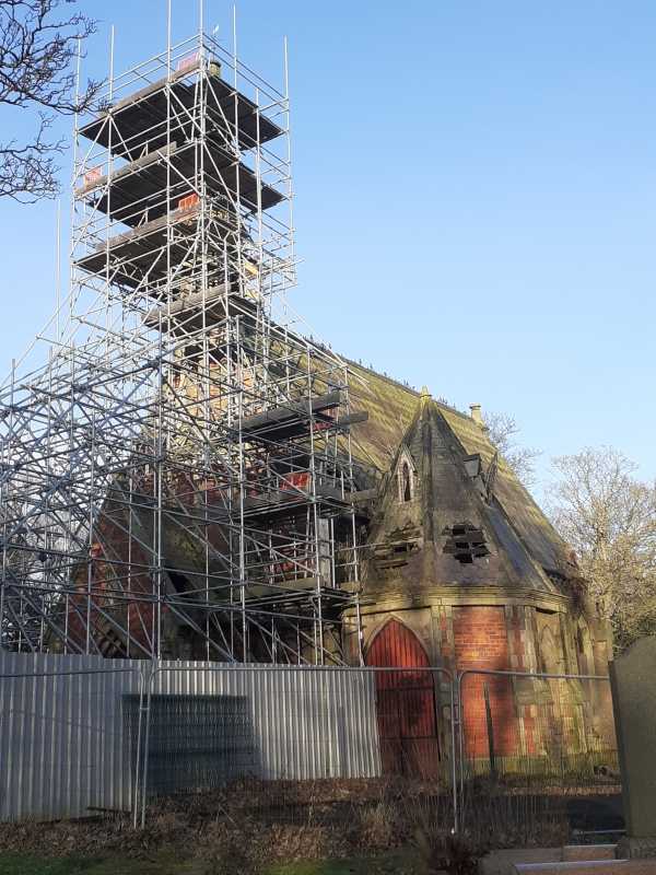
Chapel, one of identical pair for Anglican and Non-Conformist use, in municipal cemetery. 1856. By Thomas Moore. Decorated style. Brick with ashlar plinth and dressings; Welsh slate roof with fishscale decoration, ashlar gable copings and bellcote. Geographical N is ritual E. Nave and sanctuary with N vestry, W porch and SW chapel. Stone surround to high 4-light E window with drip under E gable; 3-bay nave and one-bay sanctuary have lancets with dripmoulds over plain stone surrounds, in bays defined by stepped gabled buttresses. SW octagonal chapel has hipped roof with lucarnes over windows and door. W porch, flanked by lancets, has long ogee dripmould over door in moulded pointed arch under gable on gabled angle stepped buttresses; octagonal projection behind porch rises to shafted octagonal bellcote with 2 tiers of gabled arcaded sides and stone spirelet. Steeply pitched roof has bands of fishscale patterns and gable copings. Openings blocked and building out of use at time of survey.
Listing NGR: NZ3736856258
External links are from the relevant listing authority and, where applicable, Wikidata. Wikidata IDs may be related buildings as well as this specific building. If you want to add or update a link, you will need to do so by editing the Wikidata entry.


Other nearby listed buildings