Latitude: 54.9075 / 54°54'26"N
Longitude: -1.3804 / 1°22'49"W
OS Eastings: 439827
OS Northings: 557147
OS Grid: NZ398571
Mapcode National: GBR VCX.F4
Mapcode Global: WHD55.RXW7
Plus Code: 9C6WWJ49+XV
Entry Name: 211 AND 212, HIGH STREET WEST (See details for further address information)
Listing Date: 17 October 1994
Grade: II
Source: Historic England
Source ID: 1207093
English Heritage Legacy ID: 391488
ID on this website: 101207093
Location: Sunderland, Tyne and Wear, SR1
County: Sunderland
Electoral Ward/Division: Hendon
Parish: Non Civil Parish
Built-Up Area: Sunderland
Traditional County: Durham
Lieutenancy Area (Ceremonial County): Tyne and Wear
Church of England Parish: Hendon
Church of England Diocese: Durham
Tagged with: Building
SUNDERLAND
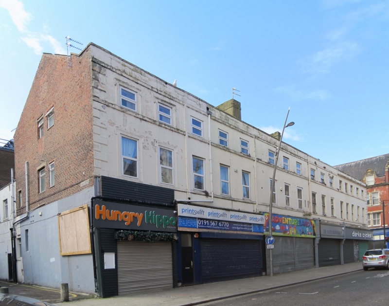
NZ3957SE HIGH STREET WEST 920-1/18/109 (South side) Nos.211 and 212 AND 214-217 (Consecutive)
II
No.213 not marked on O.S. map. Terrace of 6 houses, now shops and offices. c1800; mid C20 shops. Painted incised stucco with painted ashlar dressings. 3 storeys, 16x3 windows; 3 windows each house except end houses which have 2 each. Nos 216 and 217 are now run into one shop. Rusticated right end quoins. Windows on upper floors mostly renewed sashes, all with sill bands; label moulds to two left windows. Eaves band and blocking course except to 5 right bays which have eaves gutter cornice and blocking course. Low pitched roof, hipped at right. Small gabled dormers, at right and on right return, have glazing bars. Rendered ridge chimneys. Right return has rusticated quoins, eaves gutter cornice.
Listing NGR: NZ3982757146
External links are from the relevant listing authority and, where applicable, Wikidata. Wikidata IDs may be related buildings as well as this specific building. If you want to add or update a link, you will need to do so by editing the Wikidata entry.


Other nearby listed buildings