Latitude: 51.2098 / 51°12'35"N
Longitude: -3.4805 / 3°28'49"W
OS Eastings: 296678
OS Northings: 146661
OS Grid: SS966466
Mapcode National: GBR LJ.422G
Mapcode Global: VH5JY.MVCG
Plus Code: 9C3R6G59+WQ
Entry Name: 11, Church Street
Listing Date: 28 October 1976
Grade: II
Source: Historic England
Source ID: 1207426
English Heritage Legacy ID: 391160
ID on this website: 101207426
Location: Higher Town, Somerset, TA24
County: Somerset
District: Somerset West and Taunton
Civil Parish: Minehead
Built-Up Area: Minehead
Traditional County: Somerset
Lieutenancy Area (Ceremonial County): Somerset
Tagged with: Building
MINEHEAD
SS9646 CHURCH STREET 900-1/3/26 (West side) 28/10/76 No.11
GV II
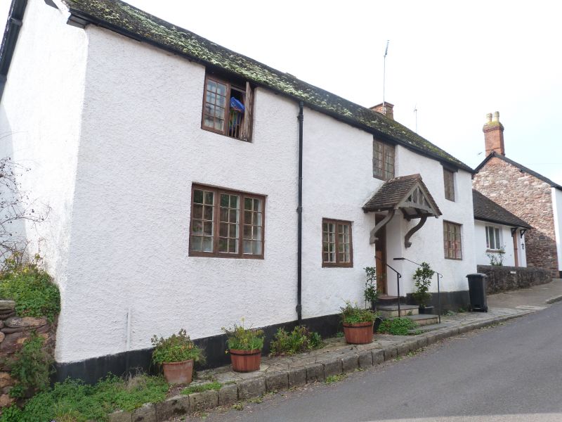
House, formerly 2 cottages. C17/C18 and C19. Painted render over rubblestone to the front, rubblestone returns, plain tile roof with brick stacks to gable ends and rear right. 2-unit central through-passage plan with rear outshut. 2 storeys; 3-window range. The right-of-centre door is under a C19 gabled porch on brackets. C19 two-light casement windows at eaves level, 3-light to the ground-floor outer ends and 2-light to the left of the door. INTERIOR: a staircase to each side suggests that these were formerly 2 cottages. The ground-floor room to the right has 2 axial beams, that to the rear has a former ovolo-moulded beam repositioned over a restored beam; an open fire to the rear has a newel stair to the right. The room to the left has an open fire to the left gable end; a door to the rear left of the through-passage opens onto stairs to the room above, the rear wall within the outshut curves to accommodate the stairs. Below these stairs, in a cupboard, the floor is of plaster. C17-C19 planked doors.
Listing NGR: SS9667846661
External links are from the relevant listing authority and, where applicable, Wikidata. Wikidata IDs may be related buildings as well as this specific building. If you want to add or update a link, you will need to do so by editing the Wikidata entry.


Other nearby listed buildings