Approximate Location Map
Large Map »
Latitude: 51.4539 / 51°27'13"N
Longitude: -2.6038 / 2°36'13"W
OS Eastings: 358139
OS Northings: 172937
OS Grid: ST581729
Mapcode National: GBR C6K.3P
Mapcode Global: VH88M.TQBB
Plus Code: 9C3VF93W+GF
Entry Name: Walls, Piers and Railings Along Road Frontage to Royal Colonnade
Listing Date: 4 March 1977
Last Amended: 30 December 1994
Grade: II
Source: Historic England
Source ID: 1207447
English Heritage Legacy ID: 379659
ID on this website: 101207447
Location: Bristol, BS1
County: City of Bristol
Electoral Ward/Division: Central
Parish: Non Civil Parish
Built-Up Area: Bristol
Traditional County: Gloucestershire
Lieutenancy Area (Ceremonial County): Bristol
Church of England Parish: Bristol St Stephen with St James and St John the Baptist with St Michael and St George
Church of England Diocese: Bristol
Tagged with: Wall
BRISTOL
ST5872NW GREAT GEORGE STREET
901-1/15/100 (North West side)
04/03/77 (Even)
Walls, piers and railings along road
frontage to Royal Colonnade
(Formerly Listed as:
GREAT GEORGE STREET
(North side)
Fence, piers and gates of Nos.12-18
(even), Royal Colonnade)
GV II
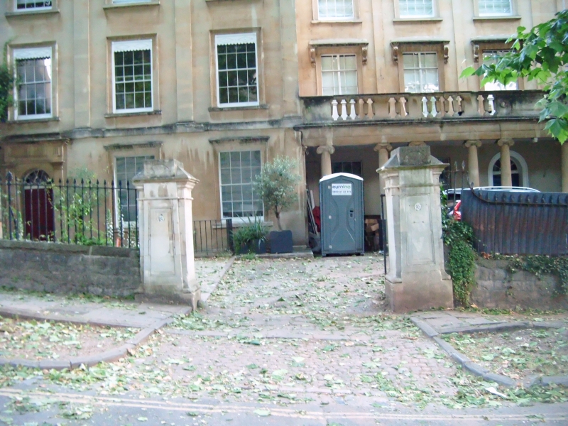
Walls, piers, railings and gates. Pennant rubble, limestone
ashlar piers and wrought-iron. 2 pairs of piers with battered
panels and caps with radiating fans, good gates and railings
with spear heads and cast anthemia. Extending approx 40m along
road frontage.
Listing NGR: ST5813972937
External links are from the relevant listing authority and, where applicable, Wikidata. Wikidata IDs may be related buildings as well as this specific building. If you want to add or update a link, you will need to do so by editing the Wikidata entry.


Other nearby listed buildings
