Latitude: 51.5594 / 51°33'33"N
Longitude: -0.1146 / 0°6'52"W
OS Eastings: 530796
OS Northings: 186185
OS Grid: TQ307861
Mapcode National: GBR FP.KSD
Mapcode Global: VHGQS.Y2SD
Plus Code: 9C3XHV5P+Q5
Entry Name: 147, Hornsey Road
Listing Date: 1 March 1990
Grade: II
Source: Historic England
Source ID: 1207570
English Heritage Legacy ID: 369025
ID on this website: 101207570
Location: Finsbury Park, Islington, London, N7
County: London
District: Islington
Electoral Ward/Division: Finsbury Park
Parish: Non Civil Parish
Built-Up Area: Islington
Traditional County: Middlesex
Lieutenancy Area (Ceremonial County): Greater London
Church of England Parish: St Mark Tollington Park
Church of England Diocese: London
Tagged with: Building
ISLINGTON
TQ3086SE HORNSEY ROAD 635-1/22/514 (West side) 01/03/90 No.147
II
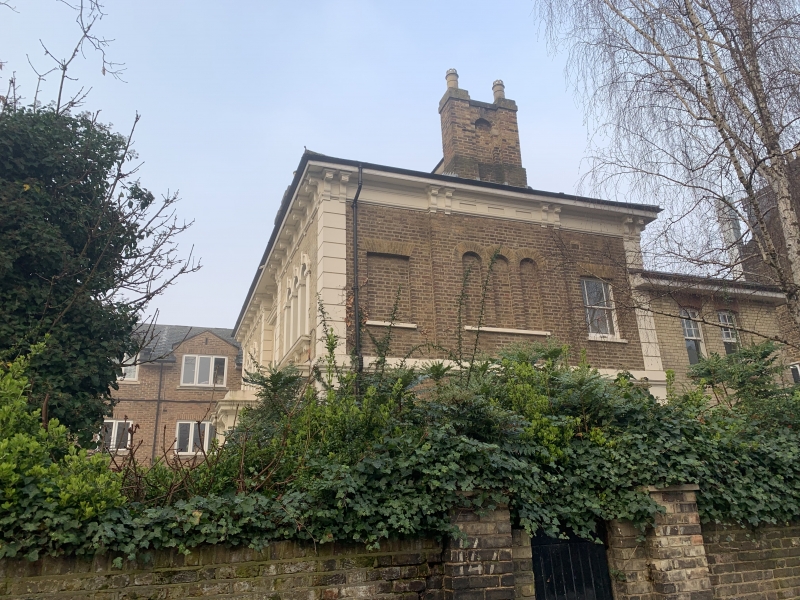
Former vicarage. 1860. Possibly by Robert Lewis Roumieu and Alexander Dick Gough. Yellow and brown brick set in Flemish bond, white brick set in English bond, red brick dressings, stucco, roof of Welsh slate. Italianate in style. The principal elevation faces south: two storeys and dormers, three-window range, double-fronted; the centre set back slightly. Rusticated pilaster strips as quoins. Stuccoed porch with round-arched entrance, cornice on consoles, blocking course. Ground-floor windows flat-arched and consisting of three narrow sashes in a substantial architrave; cornice band. Central first-floor window round-arched with architrave and cornice; on either side a group of three round-arched windows in substantial round-arched architraves; frieze and panelled eaves cornice carried on brackets. Central round-arched dormer between two stacks. Hipped roof and expressed side-stacks. East elevation in brown brick with heads of gauged yellow brick to windows of three bays, chiefly blank. Lower wing to north of white brick, with segmental-arched openings, almost certainly an addition; single-storey wing to west with shaped gable.
Listing NGR: TQ3079686185
External links are from the relevant listing authority and, where applicable, Wikidata. Wikidata IDs may be related buildings as well as this specific building. If you want to add or update a link, you will need to do so by editing the Wikidata entry.


Other nearby listed buildings