Approximate Location Map
Large Map »
Latitude: 52.6294 / 52°37'45"N
Longitude: -2.4911 / 2°29'28"W
OS Eastings: 366855
OS Northings: 303630
OS Grid: SJ668036
Mapcode National: GBR BW.7FFD
Mapcode Global: WH9DG.P5YK
Plus Code: 9C4VJGH5+QH
Entry Name: 20A, the Wharfage
Listing Date: 9 August 1974
Grade: II
Source: Historic England
Source ID: 1207998
English Heritage Legacy ID: 362238
ID on this website: 101207998
Location: Ironbridge, Telford and Wrekin, Shropshire, TF8
County: Telford and Wrekin
Civil Parish: The Gorge
Built-Up Area: Telford
Traditional County: Shropshire
Lieutenancy Area (Ceremonial County): Shropshire
Church of England Parish: Coalbrookdale
Church of England Diocese: Hereford
Tagged with: Building
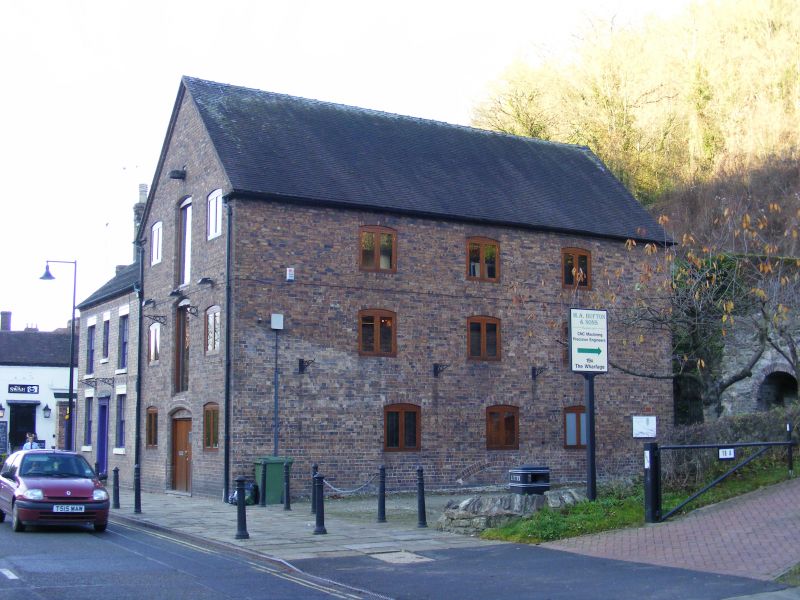
IRONBRIDGE THE WHARFAGE
1.
5362 (north side)
No 20A
SJ 6603 13/384 9.8.74
II GV
2.
Early-mid C19 warehouse building with gabled end to road. Brown brick; 3 storeys;
2 windows and central loading door to each storey, all with cambered heads.
Listing NGR: SJ6685503630
External links are from the relevant listing authority and, where applicable, Wikidata. Wikidata IDs may be related buildings as well as this specific building. If you want to add or update a link, you will need to do so by editing the Wikidata entry.


Other nearby listed buildings
