Latitude: 51.6218 / 51°37'18"N
Longitude: 0.3066 / 0°18'23"E
OS Eastings: 559772
OS Northings: 193967
OS Grid: TQ597939
Mapcode National: GBR XN.HZ1
Mapcode Global: VHHN3.8HGK
Plus Code: 9F32J8C4+PJ
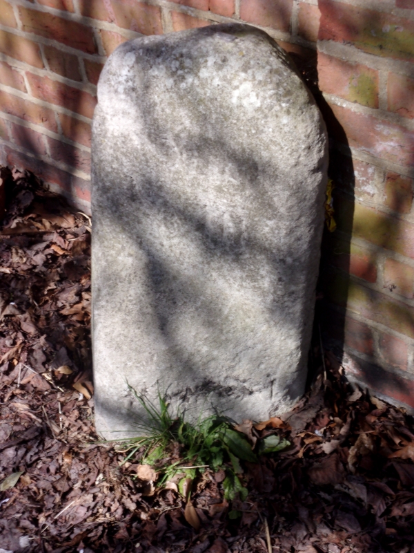
Entry Name: Milestone 13 Metres West of the Hermitage
Listing Date: 9 December 1994
Grade: II
Source: Historic England
Source ID: 1208026
English Heritage Legacy ID: 373548
ID on this website: 101208026
Location: Brentwood, Essex, CM15
County: Essex
District: Brentwood
Electoral Ward/Division: Brentwood North
Parish: Non Civil Parish
Built-Up Area: Brentwood
Traditional County: Essex
Lieutenancy Area (Ceremonial County): Essex
Church of England Parish: Brentwood St Thomas
Church of England Diocese: Chelmsford
Tagged with: Milestone
BRENTWOOD
TQ5993 SHENFIELD ROAD 723-1/12/111 (North side) Milestone 13m west of The Hermitage
GV II
Milestone set to rear of pavement. Portland stone. Now 70 cm high, square section, diagonally set, rear arris reduced, rotated (inscription on rear W face) present front cut back to serve as a base for metal post - remnant in top. Weathering and size reduction makes inscription illegible but LES of MILES and VII discernable. Other illegible inscriptions on other faces.
Listing NGR: TQ5977293967
External links are from the relevant listing authority and, where applicable, Wikidata. Wikidata IDs may be related buildings as well as this specific building. If you want to add or update a link, you will need to do so by editing the Wikidata entry.


Other nearby listed buildings