Approximate Location Map
Large Map »
Latitude: 54.5465 / 54°32'47"N
Longitude: -3.5876 / 3°35'15"W
OS Eastings: 297397
OS Northings: 517964
OS Grid: NX973179
Mapcode National: GBR 3HDV.2Z
Mapcode Global: WH5Z1.VZSG
Plus Code: 9C6RGCW6+JW
Entry Name: 28, Roper Street
Listing Date: 13 September 1972
Grade: II
Source: Historic England
Source ID: 1208082
English Heritage Legacy ID: 76040
ID on this website: 101208082
Location: Whitehaven, Cumberland, Cumbria, CA28
County: Cumbria
District: Copeland
Civil Parish: Whitehaven
Built-Up Area: Whitehaven
Traditional County: Cumberland
Lieutenancy Area (Ceremonial County): Cumbria
Church of England Parish: Whitehaven St James
Church of England Diocese: Carlisle
Tagged with: Building
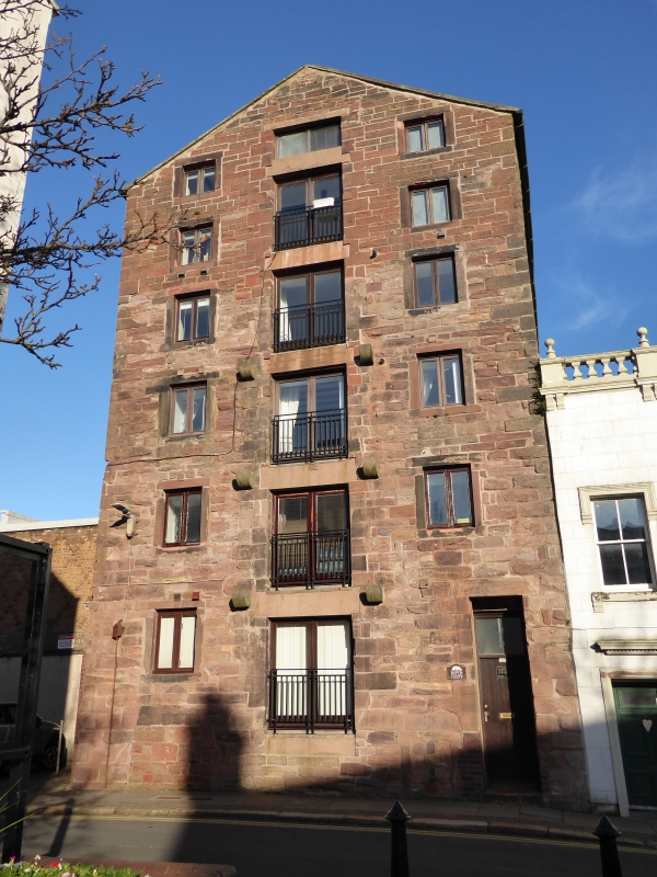
ROPER STREET
1.
1814
(North East Side)
No 28
NX 9717 NW 4/120
II GV
2.
C18 warehouse of coursed stone rubble, now cemented. 6 storeys, with a
door in centre on each storey, and with stone consoles for former platforms.
2 windows each floor.
Nos 28 to 30 (consec) and Nos 1 to 10 consec Scotch Street form a group.
Listing NGR: NX9739717964
External links are from the relevant listing authority and, where applicable, Wikidata. Wikidata IDs may be related buildings as well as this specific building. If you want to add or update a link, you will need to do so by editing the Wikidata entry.


Other nearby listed buildings
