Latitude: 53.4855 / 53°29'7"N
Longitude: -2.2327 / 2°13'57"W
OS Eastings: 384658
OS Northings: 398777
OS Grid: SJ846987
Mapcode National: GBR DMF.7K
Mapcode Global: WHB9G.PN1B
Plus Code: 9C5VFQP8+5W
Entry Name: 8, Cable Street
Listing Date: 6 June 1994
Grade: II
Source: Historic England
Source ID: 1208255
English Heritage Legacy ID: 387962
ID on this website: 101208255
Location: Ancoats, Manchester, Greater Manchester, M4
County: Manchester
Electoral Ward/Division: Ancoats and Clayton
Parish: Non Civil Parish
Built-Up Area: Manchester
Traditional County: Lancashire
Lieutenancy Area (Ceremonial County): Greater Manchester
Church of England Parish: Manchester Cathedral
Church of England Diocese: Manchester
Tagged with: Building
MANCHESTER
SJ8498 CABLE STREET, Ancoats 698-1/17/448 (North East side) No.8
GV II
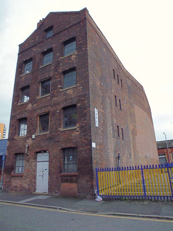
Warehouse or industrial building. Mid to later C19. Brick with some stone dressings. Rectangular. Four storeys, gable to road, 3 x 10 windows. Central segmental-headed doorway and segmental-headed windows, all these with stepped jambs in the form of simplified pilasters with moulded heads and feet; moulded brick band over top floor; rebuilt gable with central window, moulded bands to coping, and added or rebuilt chimney on left slope. Long sides similar, but with simpler windows (those to basement blocked). Rear gable wall has tiered loading doorways to right. Interior not inspected.
Listing NGR: SJ8465898777
External links are from the relevant listing authority and, where applicable, Wikidata. Wikidata IDs may be related buildings as well as this specific building. If you want to add or update a link, you will need to do so by editing the Wikidata entry.


Other nearby listed buildings