Approximate Location Map
Large Map »
Latitude: 52.6342 / 52°38'3"N
Longitude: -2.4501 / 2°27'0"W
OS Eastings: 369631
OS Northings: 304144
OS Grid: SJ696041
Mapcode National: GBR BX.75J2
Mapcode Global: WH9DH.B1HW
Plus Code: 9C4VJGMX+MW
Entry Name: Gatepiers West of the Old Vicarage
Listing Date: 8 April 1983
Grade: II*
Source: Historic England
Source ID: 1208716
English Heritage Legacy ID: 362333
ID on this website: 101208716
Location: Madeley, Telford and Wrekin, Shropshire, TF7
County: Telford and Wrekin
Civil Parish: Madeley
Built-Up Area: Telford
Traditional County: Shropshire
Lieutenancy Area (Ceremonial County): Shropshire
Church of England Parish: Madeley
Church of England Diocese: Hereford
Tagged with: Gatepost
MADELEY CHURCH STREET
1.
5362 Gatepiers west of The Old
Vicarage
SJ 6904SE 12/480
II* GV
2.
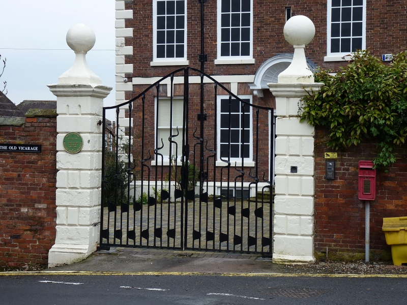
circa 1700 rusticated stone gatepiers painted, with moulded bases and caps and with
ball finials. The wrought iron gates are modern.
Listing NGR: SJ6963104144
External links are from the relevant listing authority and, where applicable, Wikidata. Wikidata IDs may be related buildings as well as this specific building. If you want to add or update a link, you will need to do so by editing the Wikidata entry.


Other nearby listed buildings
