Approximate Location Map
Large Map »
Latitude: 52.6344 / 52°38'3"N
Longitude: -2.4516 / 2°27'5"W
OS Eastings: 369530
OS Northings: 304162
OS Grid: SJ695041
Mapcode National: GBR BX.7551
Mapcode Global: WH9DH.91SR
Plus Code: 9C4VJGMX+P8
Entry Name: 8, Church Street
Listing Date: 8 April 1983
Grade: II
Source: Historic England
Source ID: 1352022
English Heritage Legacy ID: 362328
ID on this website: 101352022
Location: Madeley, Telford and Wrekin, Shropshire, TF7
County: Telford and Wrekin
Civil Parish: Madeley
Built-Up Area: Telford
Traditional County: Shropshire
Lieutenancy Area (Ceremonial County): Shropshire
Church of England Parish: Madeley
Church of England Diocese: Hereford
Tagged with: Building
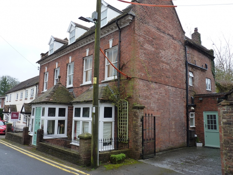
MADELEY CHURCH STREET
1.
5362 No. 8
SJ 6904SE 12/475
II GV
2.
Early C18 red brick house. Plain tile roof with brick parapet gable ends and heavy
modillion eaves cornice. Two-storeys and attic. Five bays. First floor sashes
without glazing bars, flat gauged brick arches with fluted keyblocks. Ground floor
late C19 square bay windows and large central porch.
Listing NGR: SJ6953004162
External links are from the relevant listing authority and, where applicable, Wikidata. Wikidata IDs may be related buildings as well as this specific building. If you want to add or update a link, you will need to do so by editing the Wikidata entry.


Other nearby listed buildings
