Latitude: 52.6364 / 52°38'11"N
Longitude: -1.6577 / 1°39'27"W
OS Eastings: 423261
OS Northings: 304352
OS Grid: SK232043
Mapcode National: GBR 5GS.MQL
Mapcode Global: WHCGY.HZVQ
Plus Code: 9C4WJ8PR+HW
Entry Name: Amington Centre
Listing Date: 9 November 1972
Last Amended: 28 February 1992
Grade: II
Source: Historic England
Source ID: 1208826
English Heritage Legacy ID: 386569
ID on this website: 101208826
Location: Amington, Tamworth, Staffordshire, B77
County: Staffordshire
District: Tamworth
Electoral Ward/Division: Amington
Parish: Non Civil Parish
Built-Up Area: Tamworth
Traditional County: Warwickshire
Lieutenancy Area (Ceremonial County): Staffordshire
Church of England Parish: Amington
Church of England Diocese: Birmingham
Tagged with: Architectural structure
TAMWORTH
SK20SW WOODHOUSE LANE, Amington 670-1/4/13 (West side) 09/11/72 Amington Centre (Formerly Listed as: WOODHOUSE LANE, Amington School)
II
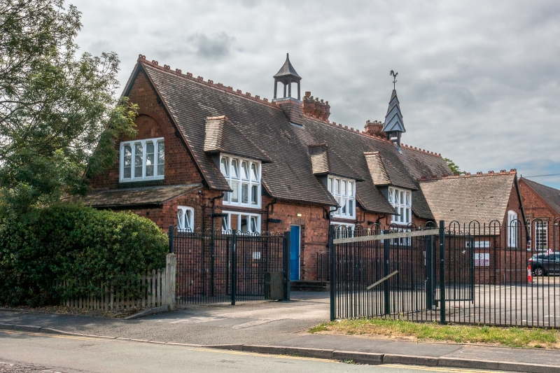
School, now community centre. 1863-4. By G.E.Street. Brick with C20 tile roof and cresting; brick valley stacks. Vernacular Revival style. Single storey; 5-window range; small gabled projection toward right end. Weathered brick base and sill course. Entrance has C20 hipped porch with glazed sides; windows project above eaves with half-hipped gables, all but one are boarded, the window to right of entrance has wooden mullioned frame of 4 lights with 2 transoms and shouldered lintels; projection has segmental-headed window with 2-light transomed wooden frame. Ridge has 2 bell turrets, one square with tile-hung base and pyramidal roof over open sides, the other has leaded fleche on 2 posts. Returns have segmental-headed windows under pointed arches with herringbone brick tympanae; that to left return over lean-to outshut; that to right over pointed entrances. Rear has attached parallel range with varied entrances and fenestration, now boarded, and 2 stacks to valley with diagonal shafts. INTERIOR: inserted C20 floor.
Listing NGR: SK2326104352
External links are from the relevant listing authority and, where applicable, Wikidata. Wikidata IDs may be related buildings as well as this specific building. If you want to add or update a link, you will need to do so by editing the Wikidata entry.


Other nearby listed buildings