Latitude: 51.4947 / 51°29'41"N
Longitude: -2.6606 / 2°39'38"W
OS Eastings: 354238
OS Northings: 177516
OS Grid: ST542775
Mapcode National: GBR JM.K5GL
Mapcode Global: VH88D.TPTH
Plus Code: 9C3VF8VQ+VQ
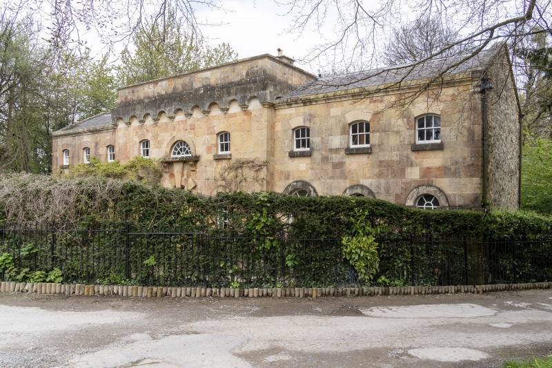
Entry Name: The Brewhouse, Kings Weston House
Listing Date: 8 January 1959
Grade: I
Source: Historic England
Source ID: 1209747
English Heritage Legacy ID: 379896
ID on this website: 101209747
Location: Lawrence Weston, Bristol, BS11
County: City of Bristol
Electoral Ward/Division: Avonmouth and Lawrence Weston
Parish: Non Civil Parish
Built-Up Area: Bristol
Traditional County: Gloucestershire
Lieutenancy Area (Ceremonial County): Bristol
Church of England Parish: Lawrence Weston St Peter
Church of England Diocese: Bristol
Tagged with: Building
BRISTOL
ST5477 KINGS WESTON LANE, Shirehampton 901-1/24/1743 (South West side) 08/01/59 The Brewhouse, Kings Weston House
GV I
Brewhouse. c1715. By Sir John Vanbrugh. Left-hand wing rebuilt 1991. Limestone ashlar. Single-depth plan. 2 storeys; 9-window range. Symmetrical front has a projecting centre with semicircular-arched ground-floor windows linked by an impost band, and flanking wings with matching doorways in the inner sides of the wings; the central doorway has 2 large voussoirs and a tall key up to a deep sill of the lunette above; first-floor windows have cambered heads; moulded parapet coping to the wings, and machicolated arcade across the centre. INTERIOR: entirely remodelled. (Gomme A, Jenner M and Little B: Bristol, An Architectural History: Bristol: 1979-: 112).
Listing NGR: ST5435777457
External links are from the relevant listing authority and, where applicable, Wikidata. Wikidata IDs may be related buildings as well as this specific building. If you want to add or update a link, you will need to do so by editing the Wikidata entry.


Other nearby listed buildings