Latitude: 53.3932 / 53°23'35"N
Longitude: -3.0177 / 3°1'3"W
OS Eastings: 332417
OS Northings: 388969
OS Grid: SJ324889
Mapcode National: GBR 7YC6.GB
Mapcode Global: WH876.MZ62
Plus Code: 9C5R9XVJ+7W
Entry Name: 22, ARGYLE STREET (See details for further address information)
Listing Date: 10 August 1992
Grade: II
Source: Historic England
Source ID: 1210015
English Heritage Legacy ID: 389096
ID on this website: 101210015
Location: Birkenhead, Wirral, Merseyside, CH41
County: Wirral
Electoral Ward/Division: Birkenhead and Tranmere
Parish: Non Civil Parish
Built-Up Area: Birkenhead
Traditional County: Cheshire
Lieutenancy Area (Ceremonial County): Merseyside
Church of England Parish: Birkenhead Christ the King
Church of England Diocese: Chester
BIRKENHEAD
SJ3288NW ARGYLE STREET 789-1/13/3 (East side) No.22
II
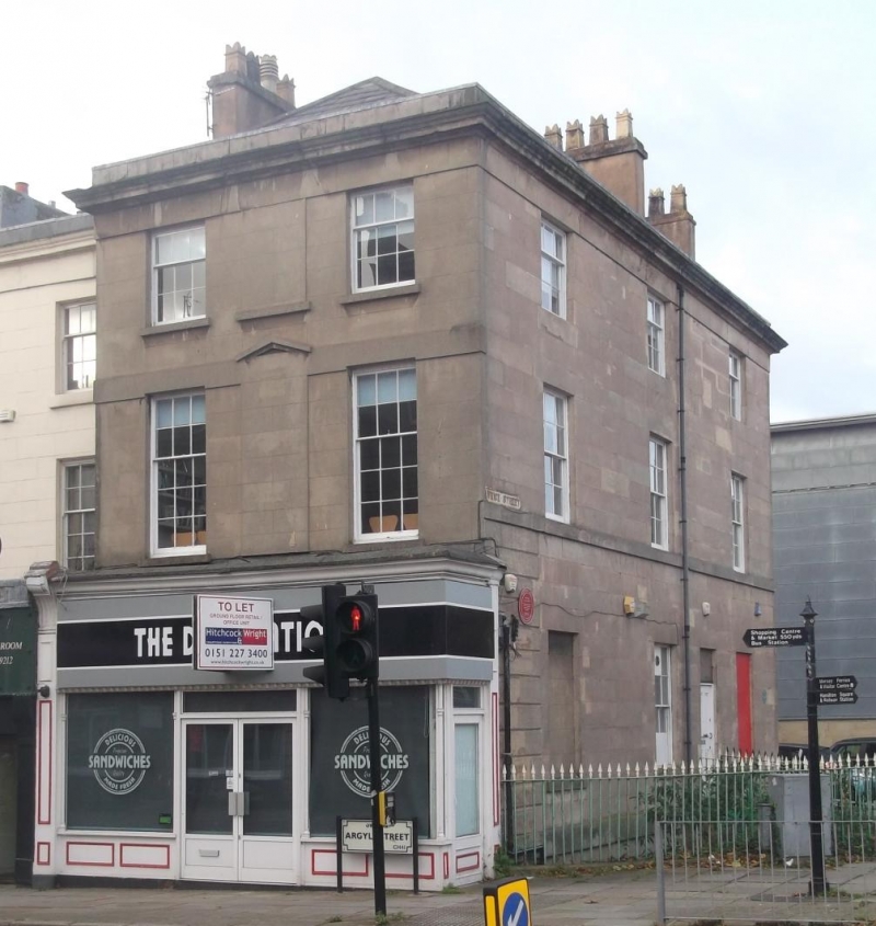
Includes: No.1 PRICE STREET. Shop, originally dwelling. c1850. Ashlar faced with Welsh slate roof. 3 storeys, 2-window range to Argyle Street frontage and blind central window, 3-window return to Price Street. Argyle Street elevation has late-C19 projecting shop front with segmentally arched windows and brackets to renewed fascia. 15-pane sash window above, with blind central window and unmoulded pediment over continuous sill band. Renewed sash windows in original openings to upper storey. Price Street elevation has rusticated ground floor with blocked window to left, and 2-pane sash windows to side of door beyond. 12-pane sashes to first floor, with continuous sill band. Upper windows are renewed original openings. End wall and lateral stacks.
Listing NGR: SJ3241788969
External links are from the relevant listing authority and, where applicable, Wikidata. Wikidata IDs may be related buildings as well as this specific building. If you want to add or update a link, you will need to do so by editing the Wikidata entry.


Other nearby listed buildings