Latitude: 53.5684 / 53°34'6"N
Longitude: -2.8829 / 2°52'58"W
OS Eastings: 341628
OS Northings: 408336
OS Grid: SD416083
Mapcode National: GBR 8W95.NK
Mapcode Global: WH86H.PKDS
Plus Code: 9C5VH498+8V
Entry Name: Number 36, Cafe Bar
Listing Date: 11 August 1972
Last Amended: 1 March 1993
Grade: II
Source: Historic England
Source ID: 1210185
English Heritage Legacy ID: 386392
ID on this website: 101210185
Location: Ormskirk, West Lancashire, L39
County: Lancashire
District: West Lancashire
Electoral Ward/Division: Scott
Parish: Non Civil Parish
Built-Up Area: Ormskirk
Traditional County: Lancashire
Lieutenancy Area (Ceremonial County): Lancashire
Church of England Parish: Ormskirk St Peter and St Paul
Church of England Diocese: Liverpool
Tagged with: Coffeehouse
SD4108SE
663-1/8/154
11/08/72
ORMSKIRK
DERBY STREET
(South side)
No.36
(Formerly Listed as:
DERBY STREET
(South side)
No.36
Commercial Hotel)
GV
II
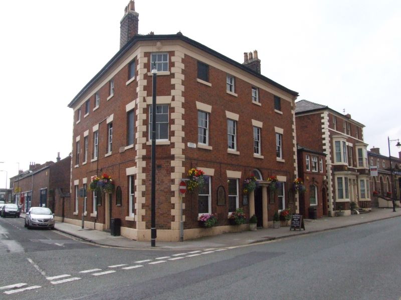
Hotel, now restaurant. Mid C19; altered.
Red brick in Flemish bond, with sandstone dressings and slate
roof. Irregular plan on corner site, with canted corner.
Three storeys over cellars, 4 windows to Derby Street, plus
canted corner to left; with a stone plinth, rusticated quoins,
plain frieze, moulded cornice and projected eaves (supported
by a large console at the right-hand corner).
The facade has a round-headed doorway in the 3rd bay, in a
stone architrave of fluted Doric semi-columns with
entablature, and an altered fanlight above this; and windows
with raised sills and wedge lintels, those at ground floor
with early C20 glazing, those at 1st floor with 12-pane
sashes, and the centre pair at 2nd floor furnished with 6-pane
sashes while the outer are blind. The canted corner to the
left has matching sashed windows at 1st and 2nd floors, and a
mask on the frieze. Various chimneys.
The left return wall (to Railway Road), 5 bays, has a doorway
in the 4th with inset pilastered doorcase and fanlight with
radiating glazing bars, and fenestration like that at the
front, including some blind windows. Forms group with Nos 11 &
13 opposite (q.v.) and with railway bridge (q.v.) and drinking
fountain (q.v.) to east.
Listing NGR: SD4162808336
External links are from the relevant listing authority and, where applicable, Wikidata. Wikidata IDs may be related buildings as well as this specific building. If you want to add or update a link, you will need to do so by editing the Wikidata entry.


Other nearby listed buildings