Latitude: 53.5684 / 53°34'6"N
Longitude: -2.8821 / 2°52'55"W
OS Eastings: 341675
OS Northings: 408340
OS Grid: SD416083
Mapcode National: GBR 8W95.TK
Mapcode Global: WH86H.PKRR
Plus Code: 9C5VH499+94
Entry Name: Railway Bridge
Listing Date: 1 March 1993
Grade: II
Source: Historic England
Source ID: 1290580
English Heritage Legacy ID: 386395
ID on this website: 101290580
Location: Ormskirk, West Lancashire, L39
County: Lancashire
District: West Lancashire
Electoral Ward/Division: Scott
Parish: Non Civil Parish
Built-Up Area: Ormskirk
Traditional County: Lancashire
Lieutenancy Area (Ceremonial County): Lancashire
Church of England Parish: Ormskirk St Peter and St Paul
Church of England Diocese: Liverpool
Tagged with: Road bridge
ORMSKIRK
SD4108SE DERBY STREET 663-1/8/158 Railway Bridge
GV II
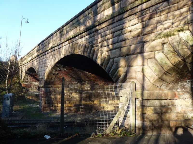
Public road bridge over cutting of Preston to Liverpool railway. c.1846-8. For the Liverpool, Ormskirk and Preston Railway. Rock-faced sandstone (with red brick soffits). Three segmental arches on rectangular piers; with large impost bands carried round the piers, stepped rusticated voussoirs, a plain band and parapet with flat coping. Soffits of brick in winding courses. Forms group with Drinking Fountain (q.v.) built into south-west corner, and with Nos 11 and 13 (q.v.)and No.36 (q.v.).
Listing NGR: SD4167508340
External links are from the relevant listing authority and, where applicable, Wikidata. Wikidata IDs may be related buildings as well as this specific building. If you want to add or update a link, you will need to do so by editing the Wikidata entry.


Other nearby listed buildings