Approximate Location Map
Large Map »
Latitude: 51.4177 / 51°25'3"N
Longitude: -1.5135 / 1°30'48"W
OS Eastings: 433924
OS Northings: 168854
OS Grid: SU339688
Mapcode National: GBR 706.24Q
Mapcode Global: VHC1S.QM6K
Plus Code: 9C3WCF9P+3H
Entry Name: 3A, Bridge Street
Listing Date: 8 June 1984
Grade: II
Source: Historic England
Source ID: 1210248
English Heritage Legacy ID: 394891
ID on this website: 101210248
Location: Hungerford, West Berkshire, RG17
County: West Berkshire
Civil Parish: Hungerford
Built-Up Area: Hungerford
Traditional County: Berkshire
Lieutenancy Area (Ceremonial County): Berkshire
Church of England Parish: Hungerford with Denford
Church of England Diocese: Oxford
Tagged with: Building
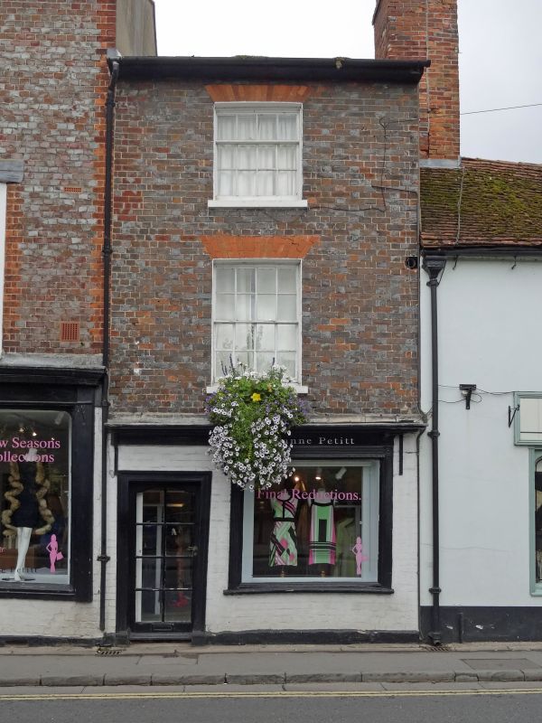
HUNGERFORD BRIDGE STREET (West Side)
SU 3368
18/14 No.3a
G.V. II
House, now house and shop. Early C19. Slate roof, wide eaves and end chimney
to right. Grey brick with red rubbed flat arches. 3 storeys. 1 glazing
bar sash on first floor, late C19 shop window and door to left under flat
hood on cut brackets.
Listing NGR: SU3392468854
External links are from the relevant listing authority and, where applicable, Wikidata. Wikidata IDs may be related buildings as well as this specific building. If you want to add or update a link, you will need to do so by editing the Wikidata entry.


Other nearby listed buildings
