Approximate Location Map
Large Map »
Latitude: 51.4175 / 51°25'3"N
Longitude: -1.5137 / 1°30'49"W
OS Eastings: 433913
OS Northings: 168837
OS Grid: SU339688
Mapcode National: GBR 706.23P
Mapcode Global: VHC1S.QM4P
Plus Code: 9C3WCF9P+2G
Entry Name: 5, Bridge Street
Listing Date: 8 June 1984
Grade: II
Source: Historic England
Source ID: 1290555
English Heritage Legacy ID: 394894
ID on this website: 101290555
Location: Hungerford, West Berkshire, RG17
County: West Berkshire
Civil Parish: Hungerford
Built-Up Area: Hungerford
Traditional County: Berkshire
Lieutenancy Area (Ceremonial County): Berkshire
Church of England Parish: Hungerford with Denford
Church of England Diocese: Oxford
Tagged with: Building
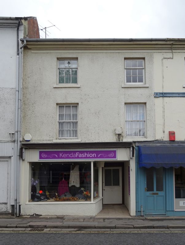
HUNGERFORD BRIDGE STREET(West Side)
SU 3368
18/59 No.5
G.V. II
House, now house and shop. C17 refronted C19. Slate roof. Painted
stucco with eaves cornice. 3 storeys. 2 glazing bar sashes, C20 shop
front with door recessed to right. Continuous with No.4 (q.v.)
Listing NGR: SU3391368837
External links are from the relevant listing authority and, where applicable, Wikidata. Wikidata IDs may be related buildings as well as this specific building. If you want to add or update a link, you will need to do so by editing the Wikidata entry.


Other nearby listed buildings
