Latitude: 50.1174 / 50°7'2"N
Longitude: -5.5387 / 5°32'19"W
OS Eastings: 147125
OS Northings: 30148
OS Grid: SW471301
Mapcode National: GBR DXPC.RRD
Mapcode Global: VH05H.Y98T
Plus Code: 9C2P4F86+XG
Entry Name: 4-8, Victoria Place
Listing Date: 7 February 1974
Grade: II
Source: Historic England
Source ID: 1210359
English Heritage Legacy ID: 394991
ID on this website: 101210359
Location: Penzance, Cornwall, TR18
County: Cornwall
Civil Parish: Penzance
Built-Up Area: Penzance
Traditional County: Cornwall
Lieutenancy Area (Ceremonial County): Cornwall
Church of England Parish: Penzance St Mary the Virgin with St Paul
Church of England Diocese: Truro
Tagged with: Building
1. 1498 PENZANCE VICTORIA PLACE
Nos 4 to 8 (consec) SW 4730 5/76B
II GV
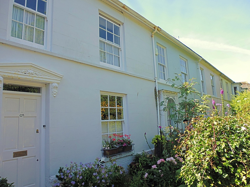
2. Early C19 stucco terrace. 2 storeys. 10 windows, sashes with glazing bars. String course. Doorways No 4 moulded architrave, No 5 flat pediment, No 6 shallow wood lattice porch, No 7 open porch with Doric columns supporting entablature with flat cornice with pendants, Slate hipped roof with. moulded eaves soffit.
Nos 2 to 8 (consec) form a group.
Listing NGR: SW4712530148
External links are from the relevant listing authority and, where applicable, Wikidata. Wikidata IDs may be related buildings as well as this specific building. If you want to add or update a link, you will need to do so by editing the Wikidata entry.


Other nearby listed buildings