Approximate Location Map
Large Map »
Latitude: 50.1107 / 50°6'38"N
Longitude: -5.5646 / 5°33'52"W
OS Eastings: 145242
OS Northings: 29488
OS Grid: SW452294
Mapcode National: GBR DXMD.CWF
Mapcode Global: VH05H.HGLZ
Plus Code: 9C2P4C6P+75
Entry Name: Gate Piers and Gate South East of Trereife Manor
Listing Date: 7 February 1974
Grade: II
Source: Historic England
Source ID: 1210366
English Heritage Legacy ID: 395002
ID on this website: 101210366
1.
1498 STABLE HOBBA
----------
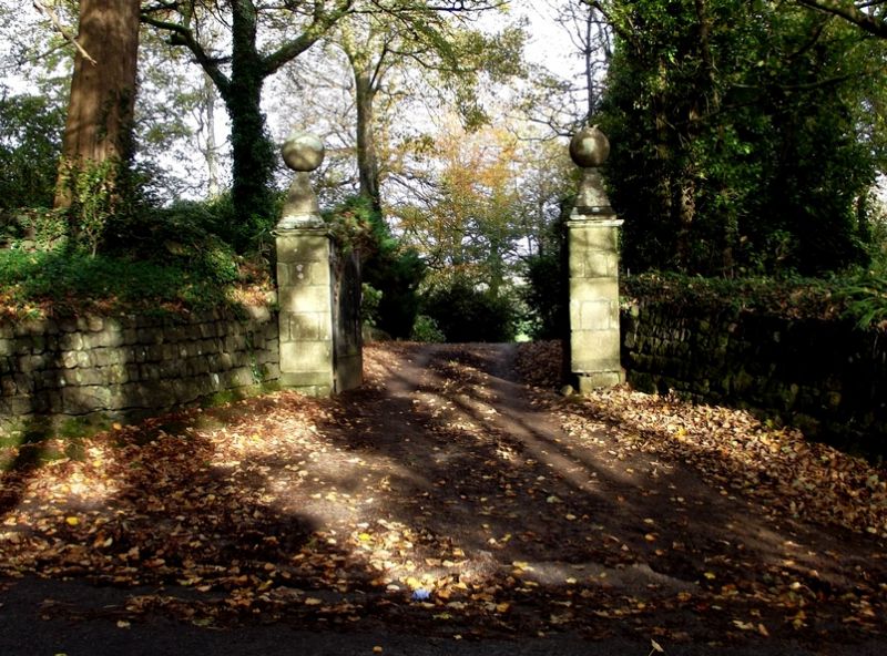
Gate Piers and Gate
south east of Trereife
Manor
SW 42 NE 2/607
SW 42 SE 2/607
II
2.
C18 granite gate piers, with cornices and pyramid caps surmounted by large ball
finials. Wrought iron gates.
Listing NGR: SW4524229488
External links are from the relevant listing authority and, where applicable, Wikidata. Wikidata IDs may be related buildings as well as this specific building. If you want to add or update a link, you will need to do so by editing the Wikidata entry.


Other nearby listed buildings
