Approximate Location Map
Large Map »
Latitude: 51.419 / 51°25'8"N
Longitude: -1.5181 / 1°31'5"W
OS Eastings: 433604
OS Northings: 168994
OS Grid: SU336689
Mapcode National: GBR 700.T69
Mapcode Global: VHC1S.MLSK
Plus Code: 9C3WCF9J+HP
Entry Name: Undy's Farm House
Listing Date: 8 June 1984
Grade: II
Source: Historic England
Source ID: 1210439
English Heritage Legacy ID: 395052
ID on this website: 101210439
Location: Hungerford, West Berkshire, RG17
County: West Berkshire
Civil Parish: Hungerford
Built-Up Area: Hungerford
Traditional County: Wiltshire
Lieutenancy Area (Ceremonial County): Berkshire
Church of England Parish: Hungerford with Denford
Church of England Diocese: Oxford
Tagged with: Farmhouse
HUNGERFORD CHARNHAM STREET (North Side)
SU 3368
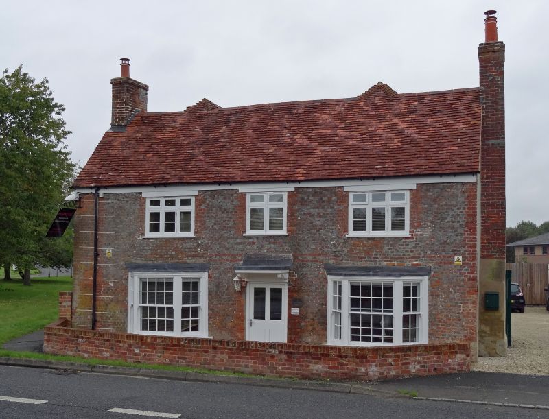
18/2 Undy's Farm House
II
House. C17 and C18. Hipped tiled roof, vitrified brick front, rendered
sides, end chimneys. H plan with 2 higher wings to rear. 2 storeys.
3 C19 casements, central door flanked by canted bays with glazing bar sashes
and flat heads.
Listing NGR: SU3360468994
External links are from the relevant listing authority and, where applicable, Wikidata. Wikidata IDs may be related buildings as well as this specific building. If you want to add or update a link, you will need to do so by editing the Wikidata entry.


Other nearby listed buildings
