Latitude: 51.4164 / 51°24'59"N
Longitude: -1.5206 / 1°31'14"W
OS Eastings: 433436
OS Northings: 168706
OS Grid: SU334687
Mapcode National: GBR 706.0DV
Mapcode Global: VHC1S.LNHK
Plus Code: 9C3WCF8H+HQ
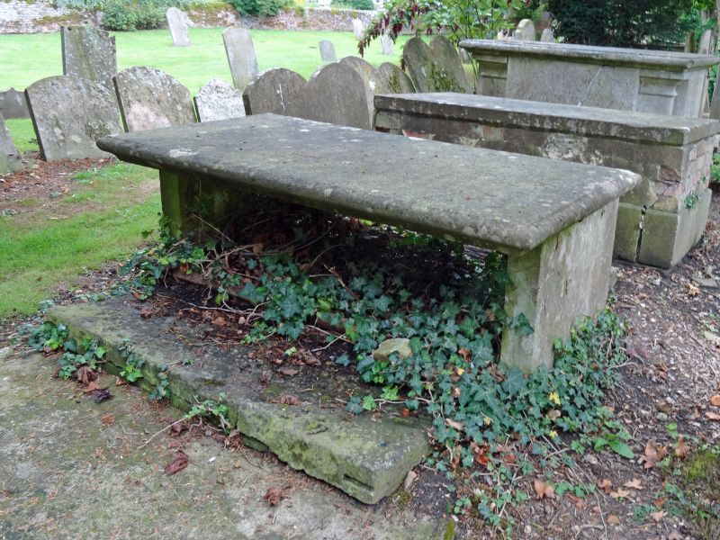
Entry Name: Robinson Tomb 8 Metres to South East of South East Corner of Church
Listing Date: 8 June 1984
Grade: II
Source: Historic England
Source ID: 1212391
English Heritage Legacy ID: 396897
ID on this website: 101212391
Location: St Lawrence's Church, Hungerford, West Berkshire, RG17
County: West Berkshire
Civil Parish: Hungerford
Built-Up Area: Hungerford
Traditional County: Berkshire
Lieutenancy Area (Ceremonial County): Berkshire
Church of England Parish: Hungerford with Denford
Church of England Diocese: Oxford
Tagged with: Tomb
HUNGERFORD PARSONAGE LANE SU 3368 18/27 Robinson Tomb 8 Metres to South East of South East corner of Church II Tomb. c1740. Stone. Flat chest with moulded overhanging top. Incised leaf decoration on sides around ovals bearing inscriptions to the memory of John Robinson.
Listing NGR: SU3343668706
External links are from the relevant listing authority and, where applicable, Wikidata. Wikidata IDs may be related buildings as well as this specific building. If you want to add or update a link, you will need to do so by editing the Wikidata entry.


Other nearby listed buildings