Latitude: 53.7488 / 53°44'55"N
Longitude: -2.714 / 2°42'50"W
OS Eastings: 353011
OS Northings: 428284
OS Grid: SD530282
Mapcode National: GBR T7P.ZG
Mapcode Global: WH85T.81VF
Plus Code: 9C5VP7XP+G9
Entry Name: Old Penwortham Bridge
Listing Date: 1 October 1962
Last Amended: 27 February 1984
Grade: II
Source: Historic England
Source ID: 1210865
English Heritage Legacy ID: 357988
ID on this website: 101210865
Location: Lower Penwortham, Preston, Lancashire, PR1
County: Lancashire
District: Preston
Electoral Ward/Division: Riversway
Parish: Non Civil Parish
Built-Up Area: Preston
Traditional County: Lancashire
Lieutenancy Area (Ceremonial County): Lancashire
Church of England Parish: Preston St Stephen
Church of England Diocese: Blackburn
SD 52NW PENWORTHAM LEYLAND ROAD
4/83 Old Penwortham Bridge October 1962 (Formerly listed as Penwortham Old Bridge II over River Ribble (that portion in Preston RD))
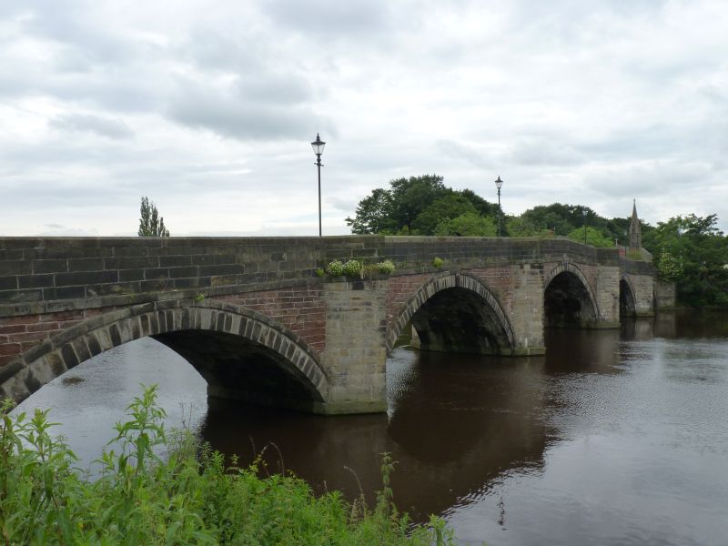
Bridge over River Ribble, 1759. Stone. Five unequal segmental arches, rising towards the centre; V-shaped cutwaters continued to the parapets to form refuges on both sides of deck; spandrels of red sandstone. Parapets, moulded at the top, turn and continue as walls on the south bank of the river c. 40 metres eastwards and c. 130 metres westwards. At the south east corner of the bridge is a low triangular stone with incised lettering: PENWORTHAM. Replaced first bridge on this site (built 1755, collapsed 1756), and until early C20 was lowest bridge over Ribble; intermittently maintained by tolls; now used as footbridge. Part of this bridge is in Preston former CB (q.v.).
Listing NGR: SD5301128284


Other nearby listed buildings