Approximate Location Map
Large Map »
Latitude: 51.4885 / 51°29'18"N
Longitude: -0.609 / 0°36'32"W
OS Eastings: 496673
OS Northings: 177532
OS Grid: SU966775
Mapcode National: GBR F8D.NTG
Mapcode Global: VHFT8.DVD9
Plus Code: 9C3XF9QR+99
Entry Name: 30, High Street
Listing Date: 4 November 1950
Grade: II
Source: Historic England
Source ID: 1211020
English Heritage Legacy ID: 395606
ID on this website: 101211020
Location: Eton, Windsor and Maidenhead, Berkshire, SL4
County: Windsor and Maidenhead
Civil Parish: Eton
Built-Up Area: Eton
Traditional County: Buckinghamshire
Lieutenancy Area (Ceremonial County): Berkshire
Church of England Parish: Eton
Church of England Diocese: Oxford
Tagged with: Building
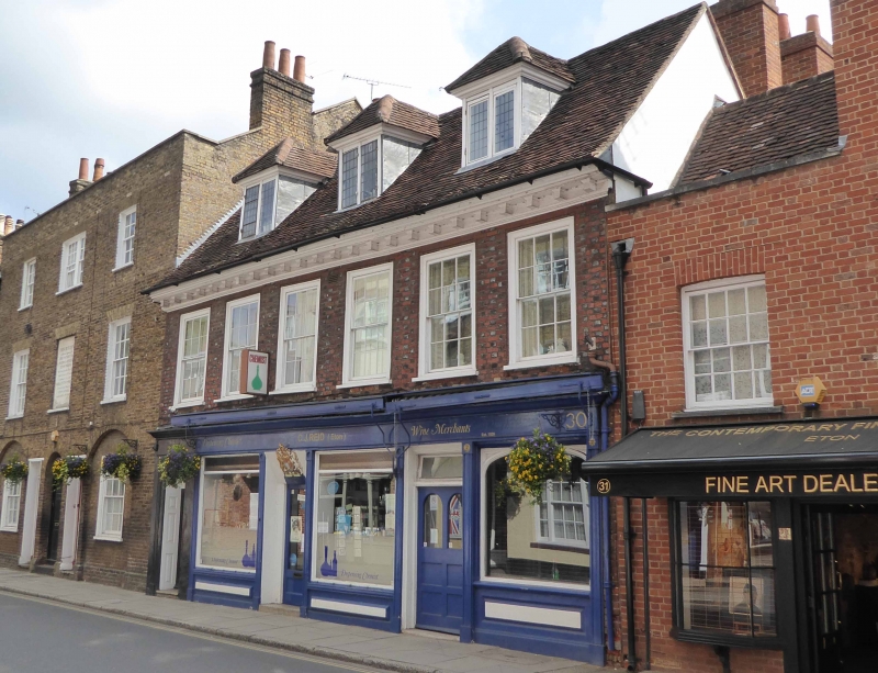
1. HIGH STREET
1909 (East Side)
No 30
SU 9677 NE 1/19 4.11.50.
II GV
2.
Early C18. Red and grey brick, 2 storeys and attics, 6 double-hung sashes in
surrounds with flat arches and wood sills. C19 ground floor shop front. Modillion
cornice, old tile roof, 3 hipped dormers with lattice casements. Glazing bars
to sashes.
Nos 17 to 33 (consec) form a group.
Listing NGR: SU9667577535
External links are from the relevant listing authority and, where applicable, Wikidata. Wikidata IDs may be related buildings as well as this specific building. If you want to add or update a link, you will need to do so by editing the Wikidata entry.


Other nearby listed buildings
