Latitude: 51.4887 / 51°29'19"N
Longitude: -0.6094 / 0°36'33"W
OS Eastings: 496649
OS Northings: 177551
OS Grid: SU966775
Mapcode National: GBR F8D.NR6
Mapcode Global: VHFT8.DV65
Plus Code: 9C3XF9QR+F7
Entry Name: 117 and 117A, High Street
Listing Date: 4 November 1950
Grade: II
Source: Historic England
Source ID: 1290022
English Heritage Legacy ID: 395920
ID on this website: 101290022
Location: Eton, Windsor and Maidenhead, Berkshire, SL4
County: Windsor and Maidenhead
Civil Parish: Eton
Built-Up Area: Eton
Traditional County: Buckinghamshire
Lieutenancy Area (Ceremonial County): Berkshire
Church of England Parish: Eton
Church of England Diocese: Oxford
Tagged with: Building
1. HIGH STREET 1909 (West Side)
Nos 117 and 117A SU 9677 NE 1/81 4.11.50. II
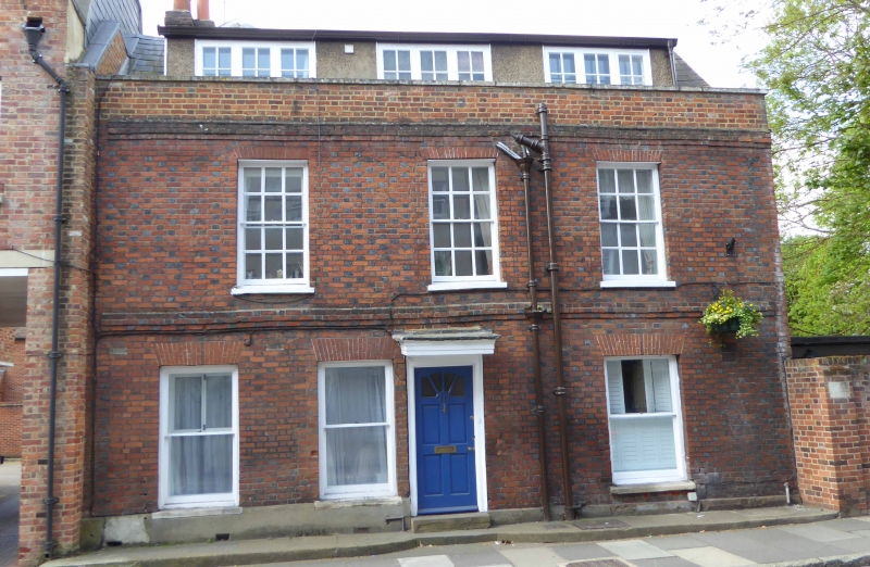
2. Mid C18. Red and grey stretchers and headers. 2 storeys and attics, 3 double-hung sashes in reveals with sills and rubbed flat arches, ground floor windows without glazing bars. Door cornice-hood, 5-panel door in surround, 1 panel replaced by glass, 2 panels flush. 1st floor and cornice level brick bands, parapet, modern dormers, Welsh slate roof.
Listing NGR: SU9665077554
External links are from the relevant listing authority and, where applicable, Wikidata. Wikidata IDs may be related buildings as well as this specific building. If you want to add or update a link, you will need to do so by editing the Wikidata entry.


Other nearby listed buildings