Approximate Location Map
Large Map »
Latitude: 51.4934 / 51°29'36"N
Longitude: -0.6074 / 0°36'26"W
OS Eastings: 496774
OS Northings: 178081
OS Grid: SU967780
Mapcode National: GBR F8D.98C
Mapcode Global: VHFT8.FQ7J
Plus Code: 9C3XF9VV+92
Entry Name: The Wall, Eton College
Listing Date: 14 May 1973
Grade: II
Source: Historic England
Source ID: 1211453
English Heritage Legacy ID: 395979
ID on this website: 101211453
Location: Eton, Windsor and Maidenhead, Berkshire, SL4
County: Windsor and Maidenhead
Civil Parish: Eton
Built-Up Area: Eton
Traditional County: Buckinghamshire
Lieutenancy Area (Ceremonial County): Berkshire
Church of England Parish: Eton
Church of England Diocese: Oxford
Tagged with: Wall
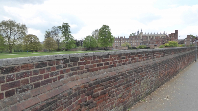
1. SLOUGH ROAD
1909 (East Side)
The Wall, Eton College
SU 9678 SE 3/79
II
2.
Circa 1717 red brick wall with stone coping. Scene of the famous "wall game",
probably originating in the mid C18.
Listing NGR: SU9677478081
External links are from the relevant listing authority and, where applicable, Wikidata. Wikidata IDs may be related buildings as well as this specific building. If you want to add or update a link, you will need to do so by editing the Wikidata entry.


Other nearby listed buildings
