Latitude: 50.2704 / 50°16'13"N
Longitude: -4.7871 / 4°47'13"W
OS Eastings: 201485
OS Northings: 44870
OS Grid: SX014448
Mapcode National: GBR ZX.G5WW
Mapcode Global: FRA 08V9.YNC
Plus Code: 9C2Q76C7+45
Entry Name: Post Office
Listing Date: 11 March 1974
Grade: II
Source: Historic England
Source ID: 1211487
English Heritage Legacy ID: 396013
ID on this website: 101211487
Location: Trevarth Estate, Cornwall, PL26
County: Cornwall
Civil Parish: Mevagissey
Built-Up Area: Mevagissey
Traditional County: Cornwall
Lieutenancy Area (Ceremonial County): Cornwall
Church of England Parish: Mevagissey
Church of England Diocese: Truro
Tagged with: Post office
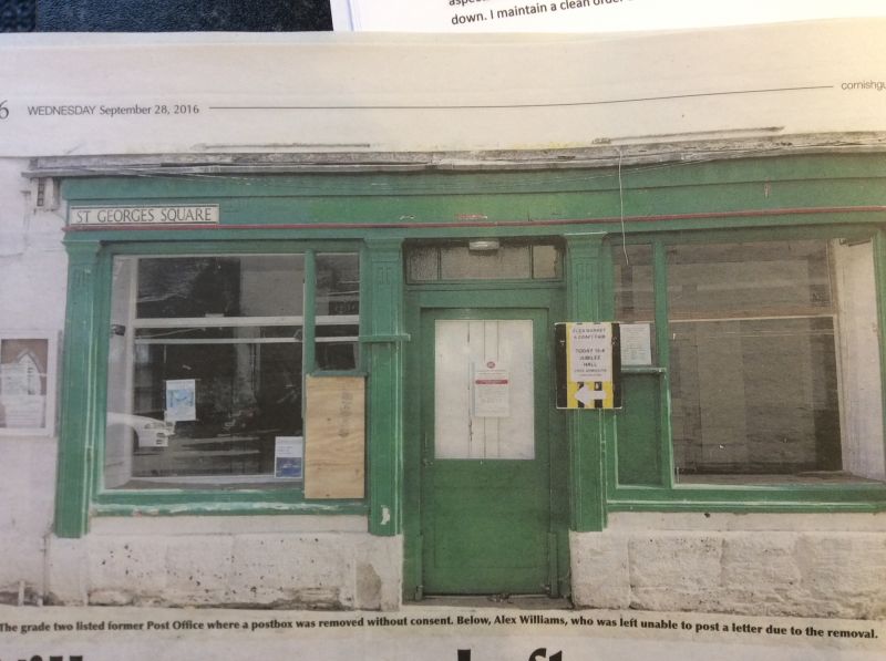
MEVAGISSEY
1. ST GEORGE'S SQUARE
1584A (East Side)
No 3 (Post Office)
SX 04 NW 3/606
II GV
2.
Early C19. Painted brick. 3 storeys, 3 sashes, no glazing bars on 1st
floor. C19 shop with flat pilasters. Side elevation painted rubble and
2 sashes. Steep slate hipped roof.
Nos 1 to 4 (consec) form a group.
Listing NGR: SX0148944872
External links are from the relevant listing authority and, where applicable, Wikidata. Wikidata IDs may be related buildings as well as this specific building. If you want to add or update a link, you will need to do so by editing the Wikidata entry.


Other nearby listed buildings