Approximate Location Map
Large Map »
Latitude: 50.2703 / 50°16'13"N
Longitude: -4.7873 / 4°47'14"W
OS Eastings: 201471
OS Northings: 44866
OS Grid: SX014448
Mapcode National: GBR ZX.G5TP
Mapcode Global: FRA 08V9.YKS
Plus Code: 9C2Q76C7+43
Entry Name: 1 and 2, St George's Square
Listing Date: 11 March 1974
Grade: II
Source: Historic England
Source ID: 1211618
English Heritage Legacy ID: 396012
ID on this website: 101211618
Location: Trevarth Estate, Cornwall, PL26
County: Cornwall
Civil Parish: Mevagissey
Built-Up Area: Mevagissey
Traditional County: Cornwall
Lieutenancy Area (Ceremonial County): Cornwall
Church of England Parish: Mevagissey
Church of England Diocese: Truro
Tagged with: Building
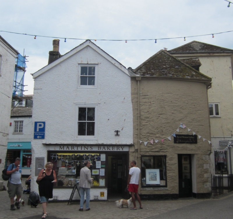
MEVAGISSEY
1. ST GEORGE'S SQUARE
1584A (South Side)
Nos 1 & 2
SX 04 NW 3/351
II GV
2.
C17 or C18. Colourwashed and partly roughcast rubble. Corner site.
Irregular. Gable and small C19 shop to front. 2 storeys and attic.
Various windows, sashes, no glazing bars. Hipped and gabled slate roof.
2 gabled dormers. Included for group value.
Nos 1 to 4 (consec) form a group.
Listing NGR: SX0147144866
External links are from the relevant listing authority and, where applicable, Wikidata. Wikidata IDs may be related buildings as well as this specific building. If you want to add or update a link, you will need to do so by editing the Wikidata entry.


Other nearby listed buildings
