Approximate Location Map
Large Map »
Latitude: 52.0159 / 52°0'57"N
Longitude: -1.0037 / 1°0'13"W
OS Eastings: 468471
OS Northings: 235747
OS Grid: SP684357
Mapcode National: GBR 9XH.K25
Mapcode Global: VHDT2.KL8F
Plus Code: 9C4W2X8W+9G
Entry Name: Manor Farmhouse
Listing Date: 21 April 1983
Grade: II
Source: Historic England
Source ID: 1211535
English Heritage Legacy ID: 396055
ID on this website: 101211535
Location: Chackmore, Buckinghamshire, MK18
County: Buckinghamshire
Civil Parish: Radclive-cum-Chackmore
Traditional County: Buckinghamshire
Lieutenancy Area (Ceremonial County): Buckinghamshire
Church of England Parish: Radclive cum Chackmore
Church of England Diocese: Oxford
Tagged with: Farmhouse
SP 63 NE RADCLIVE-CUM-CHACKMORE
3/40 MAIN STREET
(south side)
Chackmore
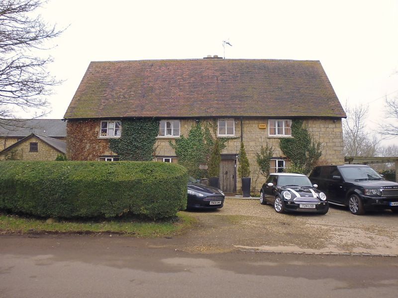
Manor Farmhouse
GV II
House. C17-early C18. Rubble stone, timber lintels to openings. Tiled
roof, central stack. 2 storeys, 4 bays. 3-light wooden casements, 2-light
over lobby entry in second right-hand bay.
Listing NGR: SP6845135755
External links are from the relevant listing authority and, where applicable, Wikidata. Wikidata IDs may be related buildings as well as this specific building. If you want to add or update a link, you will need to do so by editing the Wikidata entry.


Other nearby listed buildings
