Approximate Location Map
Large Map »
Latitude: 54.4034 / 54°24'12"N
Longitude: -1.7357 / 1°44'8"W
OS Eastings: 417251
OS Northings: 500919
OS Grid: NZ172009
Mapcode National: GBR JKBJ.08
Mapcode Global: WHC6D.9LP3
Plus Code: 9C6WC737+9P
Entry Name: 17, Frenchgate
Listing Date: 15 January 1973
Last Amended: 15 October 1973
Grade: II
Source: Historic England
Source ID: 1211908
English Heritage Legacy ID: 322955
ID on this website: 101211908
Location: Richmond, North Yorkshire, DL10
County: North Yorkshire
District: Richmondshire
Civil Parish: Richmond
Built-Up Area: Richmond
Traditional County: Yorkshire
Lieutenancy Area (Ceremonial County): North Yorkshire
Church of England Parish: Richmond with Holy Trinity with Hudswell
Church of England Diocese: Leeds
Tagged with: Building
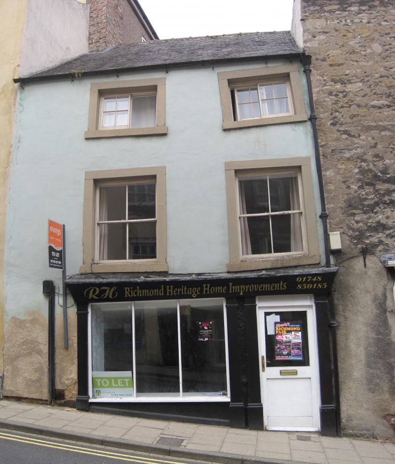
1. FRENCHGATE
1549 (West Side)
No 17
NZ 1700 NW 1/361
II GV
2.
C18. Three storeys, roughcast. Welsh slate roof. Two windows, stone
surrounds, hung cashes, top floor has glazing bars. C19 shop front with
thin pilasters, fascia continues over half-glazed modern door in pilastered
architrave.
Listing NGR: NZ1725100919
External links are from the relevant listing authority and, where applicable, Wikidata. Wikidata IDs may be related buildings as well as this specific building. If you want to add or update a link, you will need to do so by editing the Wikidata entry.


Other nearby listed buildings
