Latitude: 50.3384 / 50°20'18"N
Longitude: -4.7923 / 4°47'32"W
OS Eastings: 201393
OS Northings: 52452
OS Grid: SX013524
Mapcode National: GBR ZX.9Y7R
Mapcode Global: FRA 08V4.NS9
Plus Code: 9C2Q86Q5+93
Entry Name: Drinking Fountain
Listing Date: 11 March 1974
Grade: II
Source: Historic England
Source ID: 1212187
English Heritage Legacy ID: 396593
ID on this website: 101212187
Location: St Austell, Cornwall, PL25
County: Cornwall
Civil Parish: St Austell
Built-Up Area: St Austell
Traditional County: Cornwall
Lieutenancy Area (Ceremonial County): Cornwall
Church of England Parish: St Austell
Church of England Diocese: Truro
Tagged with: Drinking fountain
ST AUSTELL
1. MARKET STREET
1584A (South Side)
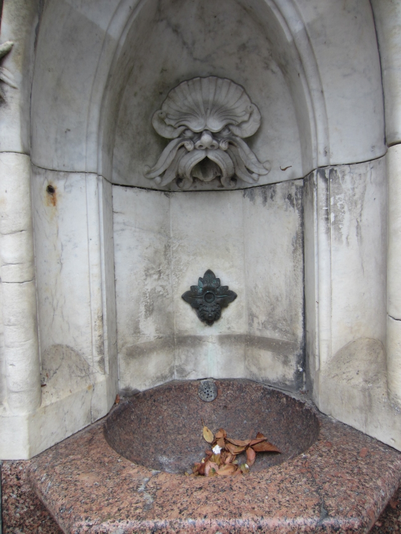
Drinking Fountain
SX 0152 1/159
II
2.
Dated 1890. Drinking fountain. Marble with polished granite bowl and
columns to sides of pointed arch niche. Its roof is surmounted by elaborate
cast iron lamp standard.
Listing NGR: SX0139352452
External links are from the relevant listing authority and, where applicable, Wikidata. Wikidata IDs may be related buildings as well as this specific building. If you want to add or update a link, you will need to do so by editing the Wikidata entry.


Other nearby listed buildings