Latitude: 54.0545 / 54°3'16"N
Longitude: -2.7965 / 2°47'47"W
OS Eastings: 347956
OS Northings: 462355
OS Grid: SD479623
Mapcode National: GBR 8PXK.CB
Mapcode Global: WH847.0CM2
Plus Code: 9C6V3633+RC
Entry Name: Skerton Bridge
Listing Date: 18 February 1970
Grade: II*
Source: Historic England
Source ID: 1212253
English Heritage Legacy ID: 383253
ID on this website: 101212253
Location: Bulk, Lancaster, Lancashire, LA1
County: Lancashire
District: Lancaster
Electoral Ward/Division: Skerton East
Parish: Non Civil Parish
Built-Up Area: Lancaster
Traditional County: Lancashire
Lieutenancy Area (Ceremonial County): Lancashire
Church of England Parish: Lancaster St Mary with St John and St Anne
Church of England Diocese: Blackburn
Tagged with: Arch bridge Road bridge
LANCASTER
SD4762 PARLIAMENT STREET 1685-1/3/220 (North side (off)) 18/02/70 Skerton Bridge
II*
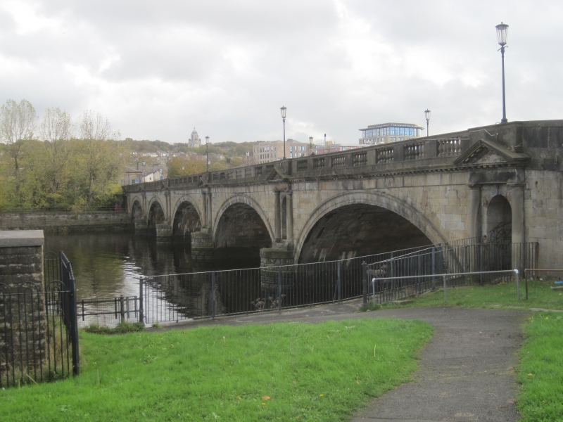
Public road bridge over River Lune. Completed 1788, altered c1849. By Thomas Harrison (Architect), Messrs Mesham (Builders), and Edward Exley (Carpenter). Sandstone ashlar. 5 gracefully shallow semi-elliptical arches with archbands, and above the semicircular cutwaters between them are aediculed niches with mutuled pediments and engaged Tuscan columns. The whole is crossed by a cornice with mutules, and a balustraded parapet in which plain panels alternate with groups of 6 balusters. The ramped approach at the east end was altered to make a passage for the 'Little' North-western Railway, opened in 1849.
Listing NGR: SD4795662355
External links are from the relevant listing authority and, where applicable, Wikidata. Wikidata IDs may be related buildings as well as this specific building. If you want to add or update a link, you will need to do so by editing the Wikidata entry.


Other nearby listed buildings